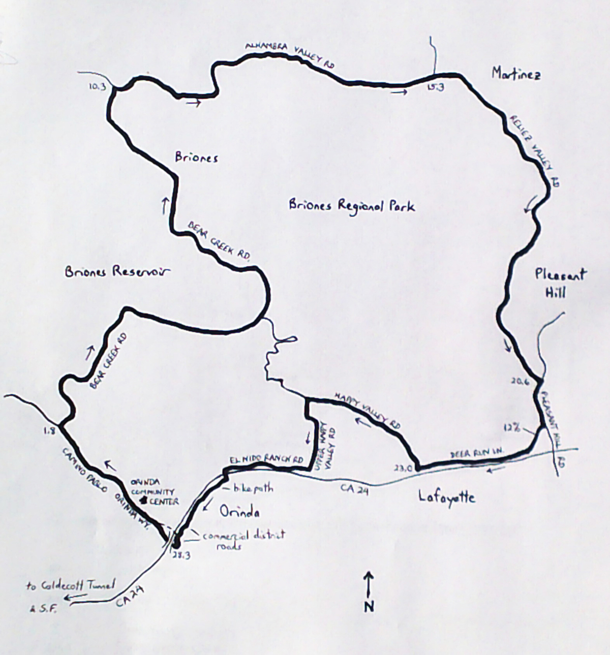
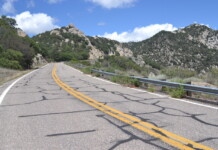
By Wayne Cottrell — The Three Bears & Briones road bike ride follows a portion of the famous Berkeley Hills Road Race (BHRR) route in the East Bay, near San Francisco, California. The ride is a 28.8-mile clockwise loop that includes plenty of climbing and descending, roughly following the perimeter of Briones Regional Park. At 6,255 acres, Briones is the largest in the East Bay Regional Park District, which itself is the largest in the U.S. All three Bears, located along Bear Creek Road, are included, along with a few more hills. As for the Bears, this ride executes them in the opposite direction of the BHRR.

Because of the COVID-19 pandemic, the race has not been held since 2019 (riders have raced the route on their own within a one-month window toward the end of the summer). Perhaps the traditional race will return in 2022? Die-hard racers and cycling historians are hopeful, as the BHRR is the oldest road race in the U.S., first held in 1957. For the pro and elite men, it is a grueling, five-lap, 100-mile race that traverses each of the Three Bears five times, for 15 total climbs. Plenty of name cyclists have competed and won here, although no rider has ever won it more than twice.
One of the most notable and notorious winners was Jonathan Boyer, who won in 1979, and two years later became the first American to race in the Tour de France. Five-time Olympic speed skating gold medalist Eric Heiden won in 1983, after he had made the switch to cycling. He, too, became a Tour de France veteran, and was a founder of the 7-Eleven pro team.
Nicole Freedman turned plenty of heads when she won the pro-elite men’s race in 1996, before the women had their own separate race. (She came back to win that one, too, in 2001). Some of the guys in the 1996 field are still dealing with the demoralization. I recall doing the BHRR once when I was younger, in one of the lower categories, and making it through just one lap.
Three Bears & Briones, described more fully in Falcon Guides’ Best Bike Rides San Francisco, stages at the Orinda Community Center in Orinda. To get there from San Francisco, head east across the Bay Bridge on I-80. Exit to I-580 eastbound, and then California State Highway 24 (CA 24) eastbound. Pass through Caldecott Tunnel to reach Contra Costa County. Take the Orinda exit and turn left onto Camino Pablo. After passing under the freeway, turn right on Santa Maria Way, and then left onto Orinda Way. The community center will be on the right. Alternatively, ride Bay Area Rapid Transit’s (BART) Concord line from San Francisco. Exit at the Orinda station; head north along the path, parallel to Camino Pablo, and then follow the preceding instructions.
From the community center, head north on Orinda Way (intermittently closed for special events). The road ends at Camino Pablo, north of the community district. Turn right and head north. At Bear Creek Road, turn right (mile 1.8; plenty of cyclists stage here). You are now on the BHRR course, albeit in the opposite direction. Over the next 8.5 miles, you will face the Three Bears in reverse, as you climb the back sides and descend the front sides of Baby Bear, Papa Bear, and Mama Bear in succession.
The back side of Papa Bear is longer than the front side, at 2.1 miles(!). Briones Regional Park is on the right. Briones is also the name of a small community, through which the ride passes at mile 8.1. Bear Creek Road ends at mile 10.3; turn right onto Alhambra Valley Road – you are no longer on the BHRR course. The road climbs in a series of steep stairsteps before making a sharp left-hand bend. From here, it is a long, exhilarating descent, as you head eastward. The city of Martinez is to the north; Briones Regional Park is to the south, abutting private properties that line the road. The road narrows through here, so use caution. Keep straight at the intersection with Reliez Valley Road (mile 15.3) – Alhambra Valley Road turns left here; in going straight, you are now on Reliez Valley. The road curves right and heads southward. The Alhambra Valley Staging Area (Briones Regional Park) will be on the right – a great takeoff point for trail running, hiking, and mountain biking. Enter the city of Pleasant Hill, as Reliez Valley climbs and descends. It is a very shady road, with a canopy of trees, and there are a number of traffic controls to keep motorists from speeding. Roadside signs discourage drivers from using the road for through travel.
It’s easy riding from here, right? Well, not exactly. Reliez Valley ends at Pleasant Hill Road (mile 20.6); turn right. This may be the busiest stretch of road; quickly leave it, though, with a right turn onto Deer Hill Road. You are now heading westward. Next comes the steepest climb of the ride, with a maximum grade of 12%. Deer Hill enters Lafayette, with CA 24 to your left. Across from the Lafayette BART station, on your right, is the Hill of Crosses (current status unknown). It is a memorial to U.S. soldiers killed in Iraq and Afghanistan. Turn right on Happy Valley Road at mile 23.0, to ride through Lafayette. Turn left onto Upper Happy Valley Road at mile 24.8, to return to the CA 24 environs. At the end of the road, turn right onto El Nido Ranch Road (parallels CA 24). At St. Stephens Road (mile 27.0), turn left to cross over the freeway. On the other side, turn right and head straight onto the bike path. The path deposits you in Orinda’s commercial district, which features the art deco Orinda Theater. Continue to Camino Pablo; turn right. The final obstacle of the ride is CA 24 – you can ride in the road, which can be busy, or take the parallel path. The path can be used to access Orinda BART, and to get to the other side of CA 24. Once on the other side, follow Orinda Way (or the above directions) to return to the community center. Cyclists in training may want to do another lap!
Starting & ending point coordinates: 37.882556oN 122.188078oW


