By Mel Bashore — “How was your bike ride?” I’m asked upon returning from my September 2011 ride from Oregon to Utah. It was such a hard ride, the hardest I’d ever done, that the question isn’t easily answered. I’m conflicted in my feelings about it. Maybe only time will soften some of the more awful parts of the journey. Since the trying days of my tour were mostly clustered in the last half, they are the memories that predominate. They are the most fresh and, having finished the ride only days ago, tend to crowd out the memories of good riding days.
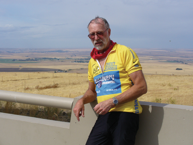
The best riding days were clustered in the first half of my three-week tour, while the most arduous were bunched in the last half. It was kind of a good ride/bad ride scenario—a Jekyll and Hyde ride, if you will.
When I first began thinking about and planning this ride, I cooked up a route that would take me 1,500 miles. My ride would begin in central Oregon, go out to and up the coast to Astoria, then east through the Columbia River Gorge, crossing Bridge of the Gods to Washington, over to Lewiston, Idaho, then to Missoula, Montana, and south through Idaho to bring me home to Salt Lake Valley. If I hurried, I thought I could do it in about 4_ weeks.
But certain events happened prior to and during the course of the trip that caused me to drastically revise my route and bring me home sooner than planned. Those events included deciding to visit a dying cousin on the trek. That would add on another hundred miles, but I’m so glad I did because he passed away just nine days after our visit. I also decided to spend more time visiting my brother in Astoria. Then after getting word that my wife would be going to the hospital for some surgery weeks earlier than originally planned, I decided to relook at things. I decided to eliminate the route through Washington to Montana and just come home along the Interstate 84 corridor. That may not have appeal for some who’ve driven that route, but everything would be new for me because I had never seen it before. And when all was said and done, I lopped off about 500 miles and got home in time for my wife’s hospital visit.
I chose to travel by train from Salt Lake to Eugene, Oregon, because they required less bike disassembling than if I were to travel by air or bus. The travel time was longer, but the seats on the train were roomy enough that I slept quite easily and enjoyed the ride. I started riding south out of Eugene in mid-afternoon, reaching my cousin’s house south of Roseburg the following day. After a short but sweet visit, I left the next day for the Oregon coast, taking a little-traveled back-way along the Umpqua River until I reached the coastal town of Reedsport.
Oregon coastal biking guidebooks had warned me about riding northward on Highway 101 because the prevailing winds blew south. My brother had told me that coastal winds often only kicked up in the afternoon, so in my usual pig-headed way, I thought I could probably reach his house in Astoria in a couple of days. I saw quite a few bike touring riders heading south (like the guidebooks recommended), but there was only one idiot going north—me. My brother had earlier told me that if conditions got too tough, he’d be happy to come rescue me in his truck. The southerly winds were brutal—too much for this 65-year-old geezer. I called in for a rescue. Had I not, I think it would have taken more than a week for me just to go those 200 coastal miles.
He picked me up in Newport, after I had completed only about 75 miles of northward riding in two days. He got a laugh out of the fact that he didn’t pull up next to me with his truck until after I had climbed all the way to the top of a grim hill. It was a happy reunion and a most welcome rescue.
I spent two days with he and his wife, enjoying their company and seeing the sights of Astoria, the oldest city west of the Rockies. Having another cousin living near Portland, he offered to haul me to her house where I might renew my journey after a nice visit. My brother and I had not seen this cousin for forty years. My bike ride was turning into a regular family reunion. My cousin recommended that instead of riding my bike through busy and hilly Portland that I take the MAX light rail. I’m glad that I took her suggestion as it got me safely out of the city to the doorstep of the Columbia River Gorge.
At Troutdale, the small town on the western end of the Gorge, I chose to bypass the hilly road of the old Historic Columbia River Highway in favor of the flatter Interstate 84. I would miss the vistas of the river, but none of the spectacular waterfalls. By taking freeway exit 30, I was able to join the old highway and see the much-photographed Multnomah Falls, eerily-captivating Oneonta Gorge, and the impressive and well-named Horsetail Falls. The old circa 1913-22 restored highway, the first officially-designated scenic highway in America, was an absolute delight to ride. I purposely rode as slowly as possible to stretch out what I thought might possibly be the highlight of my ride experience. After about ten miles of some of the most enjoyable bike riding ever, the restored section of highway ended at Warrendale. I had to re-join the modern interstate briefly, but exited to again ride on the old highway and avoid the dangerous Toothrock Tunnel that lacked any bike shoulder. So it was for the remainder of my ride through the Columbia River Gorge, sometimes riding on the old highway while at other times having to ride on Interstate 84, the old road not having been restored fully and unavailable.
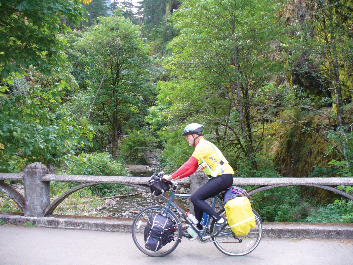
The Columbia River Gorge Bike Map guide that I received from the Oregon Department of Transportation was invaluable. Usually I don’t like to over-research my rides in advance so that I can experience serendipitous moments, but I’m glad I also requested other special biking maps for the state of Oregon and for the Oregon coast. The State of Oregon does a superb job of supporting and making bicycling safe. The maps were most useful and, in some instances, essential. (To request or download maps see http://www.oregon.gov/ODOT/HWY/BIKEPED/maps.shtm)
My ride along the Columbia River continued for another fifty miles after leaving the Gorge. The winds on the Columbia River corridor both in and east of the Gorge have made it the windsurfing capital of the world. While traveling along the Columbia River, it was my fortune to have those winds blowing in my favor. For long stretches at a time, I simply sat in the seat, enjoying an effortless ride without the necessity of pushing on the pedals. The miles flew by. At one point, I was amazed to see that I had traveled forty miles in the space of a short three hours. I couldn’t imagine traveling in the other direction against that stiff headwind. I counted my lucky stars and only hoped that I would experience favorable winds for the remainder of the journey.
I know that bike tourers favor riding on back roads and less-traveled highways rather than on interstate highways or freeways. Because of my change in plans, this would be my first extended tour on an interstate highway and I anticipated a less-enjoyable experience. In my first few days of traveling on Interstate 84 in Oregon, I was surprised to discover that interstate highway biking had a few positives. It could be noisy, but there were times when it was quiet enough for me to hear crickets and meadowlarks for minutes at a time. The extra-wide shoulders and quality of paving were unexcelled and offered me an added feeling of safety and measure of enjoyment. Whenever possible, truckers veered out to the far lane when they saw me pedaling so that their passing draft of air would not unsettle me. Less I paint too rosy a picture, I would find a few negatives when I rode Interstate 84 in Idaho.
A big part of my love of bike touring is the quest for adventure. Although many tourers prefer to sleep in motels or campgrounds, I choose to do what some call “stealth camping” but which I simply refer to as “sleeping in a ditch.” For me this adds a measure of added adventure as each evening I search out a hiding place along the roadside in which to camp. It is easy to find them in forests, but in open, farm country it is most difficult. After leaving the Columbia River, I found myself in hilly country mostly given to harvested wheat fields. One evening about ten miles shy of reaching Pendleton, I set up my tent about a quarter mile off the highway on a piece of scabby ground next to a harvested grain field. Although I was exposed more than I cared to be, I thought with luck that I might pass the night undisturbed in this somewhat out-of-the-way place. After nodding off to sleep, I was awakened about 10:30 PM by a voice booming, “Is anyone in there? State police!” I came instantly awake. After listening to my story, he wished me well on the rest of my journey and left me in peace. It was hard to get back to sleep and I vowed to pick my “ditch” more carefully on the rest of the journey.
After departing my poorly-chosen grain field camp, I scooted off to Pendleton, arriving there during their overcrowded Round-up rodeo. I think I was the only person in town not wearing a cowboy hat and boots. Feeling a bit out of place I kept on going east, quickly reaching what would be one of my most difficult hill climbs into the Blue Mountains. I alternately walked and rode up stretches of Cabbage Hill until reaching the leveled-out top of these forested mountains. It was easy to find a safe, secluded “ditch” to pitch my tent in the forest. As I continued through the Blue Mountains, much of the time I was on the actual route of the Oregon Trail, enjoying a wonderful descent into the college town of La Grande. I sought and informally received permission to bed down in the little town of North Powder. Thinking back on my earlier encounter with the police officer, I set up my tent next to the quaint single-cell 1907 city jail. If I were rousted again, they wouldn’t have far to haul me off.
The next day afforded me with a blue-ribbon ride as I left the interstate and rode parallel to it on Highway 30. I would have to rank this day’s ride as among my top ten rides ever. I enjoyed the best kind of wind, country-quiet, and flat-as-a-pancake road to Baker City. I spent a couple of very enjoyable hours in that oasis. I hadn’t known what to expect in that little city, but was pleasantly surprised at the wonderful old buildings and homes that dotted its streets. At one time it was regarded as the Queen of the Inland Empire. Since I generally eat on the run out of forgettable gas station/convenience stores, I stumbled on what looked kind of like a knock-off In ‘n Out Burger stand on the northern outskirts of Baker City. Turns out that it was built before that popular chain and seemed to have been copied by them. But the food in this circa 1954 Oregon burger joint was a notch or two above the chain, having very tasty malts and juicy burgers. My ride both into and beyond Baker on Highway 30 was superb, coursing through hills south of town on a delightful downhill run.
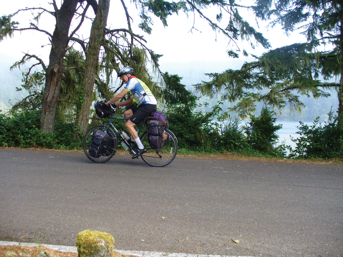
After a night in a ditch (a real ditch) on the road to Durkee’s cemetery, I sadly had to leave the old highway and return to the interstate. It was on this day’s ride as I reached the Idaho border that the Dr. Jekyll part of my ride ended and the Mr. Hyde part began to reveal itself. It was as if the state border were a curtain that, when lifted up, revealed a different side to the personality and possibilities of my early fall ride. I like to think of myself as mentally, physically, and emotionally pretty tough, but when I reached Utah after six days crossing Idaho and first spotted the Wasatch Mountains, I broke down in uncontrollable sobbing for several minutes. It had been such an arduous journey through Idaho, the most difficult I’d ever done, that I was emotionally overcome to be on the doorstep of reaching home.
What was there about this Idaho part of my ride that caused me to have such emotions at its conclusion? It is conceivable that others could take this same route at another time or season and not experience those events and conditions that were so challenging for me. I had previously enjoyed wonderful bike rides in eastern Idaho, so I don’t want to paint it all with a gloomy brush. There were even parts of my ride through Idaho that were most scenic—some even looking like what I picture the countryside of France to be like. The Thousand Springs scenic byway, stretches between Twin Falls and Burley, and the route between mountains in the Sawtooth National Forest as it neared the Utah border all had their appeal. The route along the Interstate 84 corridor in Idaho had places of memorable scenic beauty. The few hills encountered along the route were not particularly difficult to pop over. It was not any of those things that caused me my travails.
My hardships were threefold: heat, headwind, and barriers caused by road construction. I had hoped for temperate fall weather, but instead faced unseasonable 95-degree weather every day. Although I was packing five water bottles and never ran short of water, the heat seemed to take a real toll on my physical well-being. It always felt like my tongue was hanging out to dry. That feeling was probably intensified by the stiff headwinds I faced each day. They were unremitting and relentless. I ran into sections of road construction once or twice every day, sometimes lasting as much as twenty miles at a stretch. They seemed unavoidable and, in some situations, verged on being dangerous. In one instance, a safety officer thought it so dangerous that she hauled me and my bike thirteen miles to the end of the work zone. The cruelest stretch of roadwork was a ten-mile long sweep that had been prepped for a new layer of asphalt. I had to put my mind in a happy place to reach the end of that pitted and grooved, bone-shaking, roughened roadway. I dreaded, but daily expected, that I would see those ever-present orange cones and signs warning me as I neared areas of roadwork. They appeared with regularity.
Because this corridor through Idaho was principally in agricultural country, I chose to bed down each night at rest areas scattered along the highway. By law, it is legal to sleep in rest areas for a maximum of eight hours and for no more than two consecutive days. They provided me with safe, although somewhat noisy, places that I could count on to rest in an area where opportune camp spots on public land were difficult to find. I used earplugs to muffle the road noise and slept in my tent to block out the overhead lights in these rest areas. The best I can say for employing these rest areas as camps was that they were satisfactory and workable, if not the most pleasant of arrangements.
I have found that memories of past bike rides often come to mind at unexpected moments. In future days and years, will memories of this bike ride that come to the fore be those from the Dr. Jekyll or the Mr. Hyde moments? Time will tell.






I am new to touring and planning a ride similar to the one the route you originally planned: up the coast to Astoria, east through the Columbia River Gorge, over the Bridge of the Gods to Washington, over to Missoula, Montana. I am wondering if you would be willing to share route details, or resources for maps.
Thanks
Kyr
Going north up the Oregon coast is a bear! The prevailing winds all blow southeasterly and they are really stiff. For much of the way if you are going on the Coast Highway, you will actually only see the ocean about half the time. The other half the time you are too far inland to spot it. You can try it and if you discover what I’m saying is true, you can always duck inland and go up the more protected interior up through Eugene to Portland and then connect with the Columbia River Gorge. I’d love to chat with you and offer suggestions about your intended ride, so get in touch with Dave at Cycling Utah and he can give you my e-mail or phone contact. I still have my maps and route details of my ride.
Comments are closed.