The beaver seemed unusual for a beaver as it splashed around in the water 200 yards away and then started zooming in my direction. One creature turned into several, and they weren’t beaver. What were they? I was standing on a small bridge over a backed up creek, somewhere in Montana. I quietly shouted to Tony who hurried over to the bridge from our adjacent campsite, where we were packing up to start the 11th day of our 2 week bikepacking trip. We gazed down, marveling as five Northern River Otter fished their way upstream, zooming right underneath us. One leapt out onto the bank and gazed up at us. It was hard to say who got the biggest surprise, and it was one of many we savored during this journey.
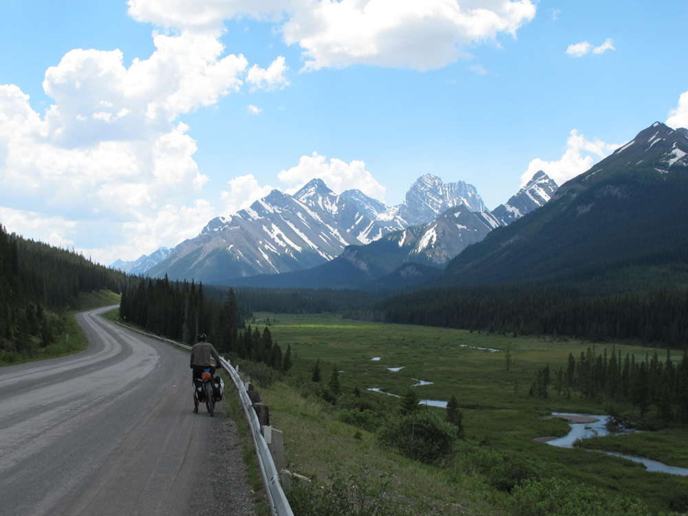
Celebrating its 20th year, the Great Divide Mountain Bike Route stretches the length of the United States, and was researched and mapped by the Adventure Cycling Association to provide a non-paved cycle touring route for those who are so inclined. The route has become internationally famous and we encountered other riders from New Zealand, England, Holland, and Germany, as well as homegrown citizens of the USA and Canada. The original start was extended to Banff, Canada, and has recently been extended even further north, while the southern terminus is at Antelope Wells on the US -Mexican border. Cyclists might attempt the whole journey in one go, as do those participating in the Tour Divide race each year, and others bite off manageable sections. We choose a bite, starting in the north to pedal our way south for 2 weeks. Some might race all the way to the Mexican border in that time, but we wanted to savor the sights and surrounds and enjoy the journey.
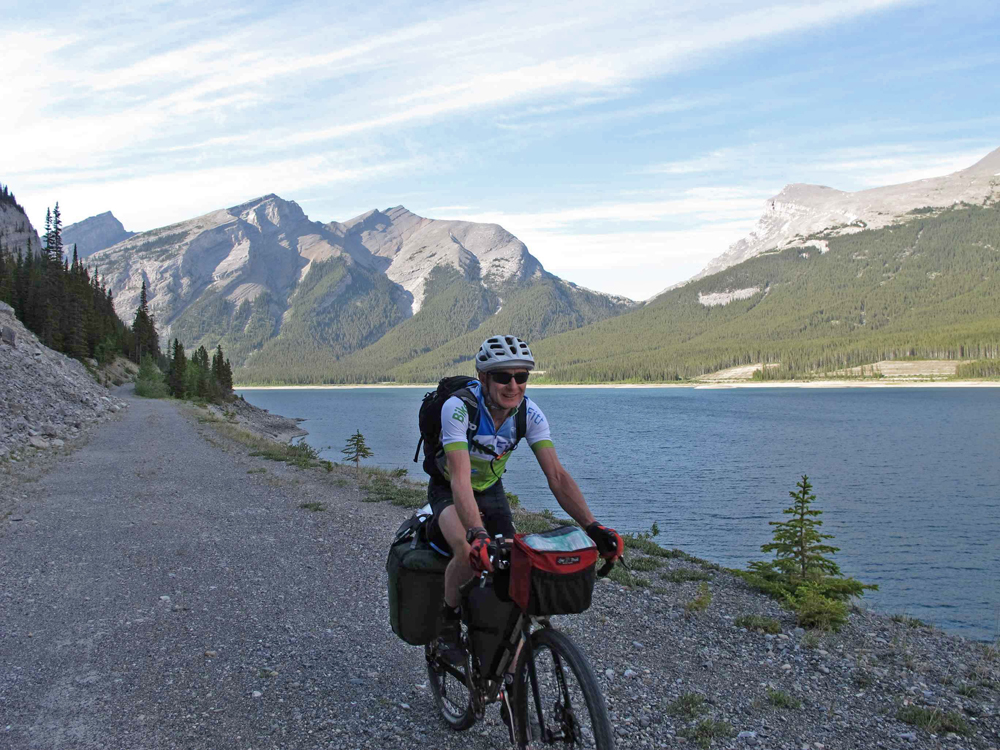
Rendezvousing in Calgary airport, we used Uber to go grocery shopping and then sorted gear and food in the hotel, prior to getting a shuttle from the airport to Banff the next morning. Two hours after arriving in Banff we had our bikes unboxed, assembled and loaded. A quick lap around Banff for “buy there” supplies like bear spray and camping gas, and we rolled out of town celebrating the start of a trip we had been considering for years, and that had already been postponed several times due to the circumstance of life. With the summer solstice providing ample daylight we got underway at 3pm and logged 4 hours of pleasant riding before settling into a lakeside camping spot to enjoy the spectacular scenery of the Canadian Rockies.
The route is well described in “Cycling the Great Divide” by Michael McCoy and in the map series published by the Adventure Cycling Association. What became quickly apparent was that although this is called a mountain bike route, it is primarily a moderate gravel road touring route and not a gnarly bikepacking sufferfest. The hyperbole warning about steep and infamous sections of trail are cautionary for those venturing off asphalt for the first time, but are barely worth a mention for experienced dirt trail cyclists. The guidebook is written from the perspective of road tourers seeking to hop from town to town to take advantage of restaurants, and campgrounds or hotels with hot showers. Our intention was to avoid “services” unless needed, and free-camp in the wilderness as much as we could. We have logged some adventurous backroad and no road touring together in the past, and were bikepacking in the wilderness well before the current surge in popularity.
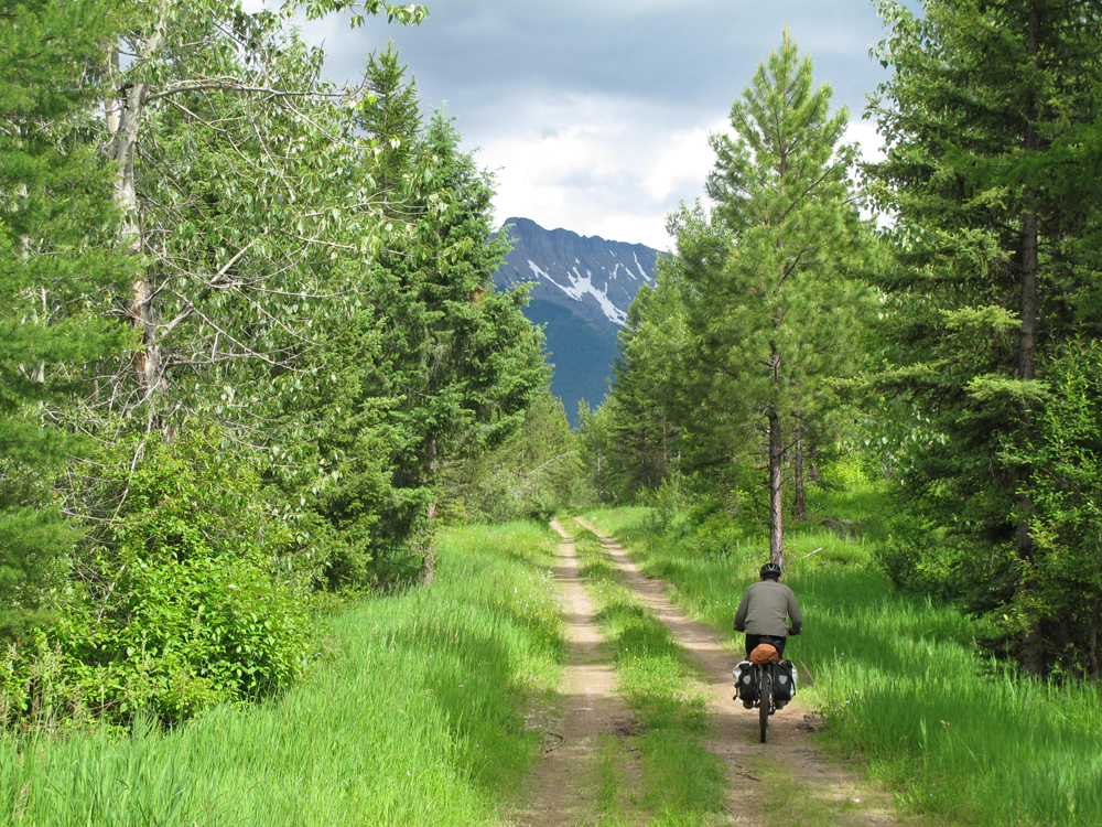
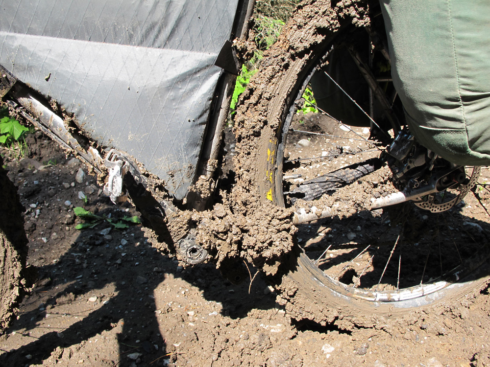
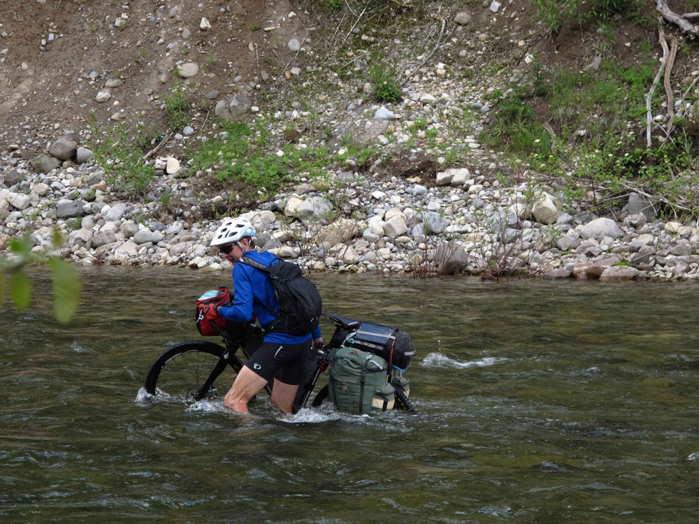
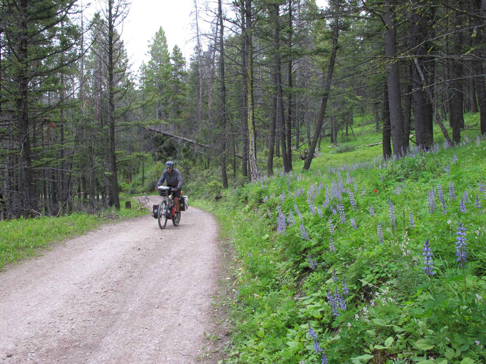
Road conditions varied from wide, well graded and travelled gravel to seldom travelled backcountry forestry roads, but our favorite were the smooth and grassed over “closed to motorized vehicles” sections. Singletrack is virtually nonexistent on the route, but the trail was livened up with some streams and rivers to negotiate. There were enough paved highway sections linking the gravel to remind me why I had quickly given up road touring and turned to gravel touring 30 years ago. The speed limit on these paved sections appeared to be AFAP. “As fast as possible”, or so it seemed to us emerging from the woods at a bicycle touring pace. We were grateful for mostly paved riding during a day of light rain, but that set us up for a wheel blocking, chain breaking mudfest ascending to Flathead Pass. The locals could have bagged and sold this stuff as adhesive. It did make spotting bear prints a lot easier though, and there were some big ones!
Speaking of bears…. two Australians biking in the North American wilds are as paranoid about bears as Americans are about poisonous snakes, spiders and crocs when they visit Australia. We did our best to warn bears of our presence via tinkling bells and loud hollering in beary areas. This strategy obviously worked well, because other than a small black bear beside the most trafficked gravel road of the trip on our second day we had not seen any, although there was plenty of evidence in the form of prints and excrement. We wanted to see a bear, preferably from a respectful distance! We’d met other riders who’d seen plenty. Finally we chanced upon a mother with 2 cubs way down the road in front of us. Most likely smelling us she quickly disappeared into the woods. In fact, wildlife sighting was not as frequent as we had expected. We traversed the Flathead River valley, regarded as the Serengeti of North America for its wildness and populations of grizzly, moose, elk, deer, wolves and much more. Our wildlife sighting tally in this region: 2 deer and 3 squirrels. The otters and second bear came later. But we did camp next to a beaver dam, complete with beaver.
Although the route takes in a lot of wild country, it also passes through towns and villages every few days, and my visiting Aussie touring companion was keen to experience small town America (including Canada). First stop, Elkford in British Columbia. We had two objectives: have a second breakfast, having hurriedly packed up in the rain from our camp near town that morning; and resupply with camping gas, which we were about out of, having only bought a couple of small cans in Banff (I scoffed at buying the large canister, assuming resupply would be easy at each town). The well-stocked supermarket had everything – except camping gas. Note: we are talking iso-propane butane for backpacking stoves, not propane in green bottles. Ok then, how about second breakfast? We settled into a small diner inside a gas station and eyed the enticing menu. The server came over and informed us the kitchen had closed at 10.45am. It was 10.50am. What diner closes at 10.45am for the day? Seeking an alternative recommendation we were directed to a pizza place that apparently served more than pizza. On the way we detoured into the two other stores in town looking for camping gas, to no avail. Inside the pizza place we noted with enthusiasm the big breakfast platter being devoured on the table next to us, but the menu showed no such feast, just pizza. After pondering this for a while we made enquiries with our server. “Breakfast is over at 11.00am.” It was 11.03am. With our best foreign accents we cajoled a breakfast time extension out of the cook. This town seriously needs an all-day breakfast option!
With rain dripping on us we pedaled the pavement to Sparwood just down the road. The staff in the visitor center told us the camping ground had no store, but we could refill our gas bottles at the gas station. Wrong type of gas! No one there had ever heard of the other type. Both towns seemed oblivious to the fact that bicycle tourers have been passing through and seeking resupplies and services (and breakfast) for 20 years. Their local economies are defiantly holding on to their coal mining and logging heritage, and banking on these industries for the future as well. Good luck with that!
Lack of a functional camp stove (no gas until Eureka, Montana) caused us to dust off our campfire building skills, and enjoy an open fire each morning and evening to prepare meals. Given the precipitation and damp verdant forest, starting a wildfire would have been challenging to do, so we rose to the campfire challenge with some pride, aided by having both learnt campcraft skills before lightweight camping stoves were a thing. On this northern section of the route surface water is abundant and informal but very adequate campsites could be encountered every 5 or 10 miles. Our choice pick was by a bridge where we had easy access to water and could hang our bear bag with ease from the structure, versus a time consuming throwing competition into some tall narrow pine tree.
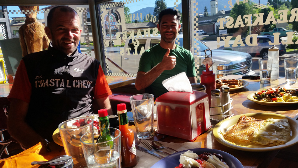
Crossing the border into the United States at Roosville was a mellow affair compared to the bureaucracy and procedure at the airport. No cameras, finger print scans or shakedowns. Very civilized and welcoming. And the small towns that we encountered in Montana made a point of welcoming cyclists with information, services and even camping gas! Eureka offers up a free campground, shower and toilet at the Chamber of Commerce, and there are a couple of outstanding eateries a short stroll away, with one serving ALL DAY BREAKFAST. However the bucolic charm of this small town took a turn for the worse at night, earning it a new marketing tagline: “Exhaust noise capital of Montana”. Apparently the louder your exhaust system, the greater your manhood, and there was a lot of audible testosterone from dusk to dawn, rendering sleep a scarce commodity. We fled back into the wilds, cresting the Whitefish Divide and then cruising down the west side of Glacier National Park before camping high up next to an alpine lake. Bliss.
Suspect play in Tony’s bottom bracket led us into Whitefish in search of a bike shop for a diagnosis and replacement. Glacier Cyclery took in the bike on the spot, assessed and replaced the bottom bracket, and had us rolling again in an hour and a half, while telling non-tourers looking for repairs that they were booked a week out. The priority service was much appreciated, barely giving us enough time to do justice to the fine offerings at Loula’s Café and pie shop a few doors away.
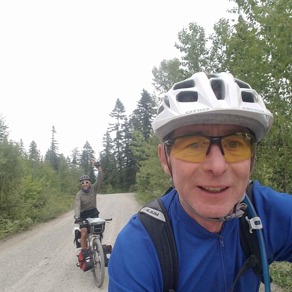
Back in Eureka we had encountered two New Zealanders taking their winter off to bikepack the full route, and we teamed up for a few days. A shared highlight was an overnight stay in the backyard of Great Divide route hosts Tom and Patty. Here and there along the route are kind and generous souls who open their door, fridge, yard, cabin and lives to random strangers who happen to be riding past. Their reward is meeting people from around the world without leaving home, and as tourists we gained insight and perspective into the lives of other people who we normally wouldn’t encounter. Further down the trail we stayed with Barbara and her husband, who actively practice a “pay it forward” philosophy of doing good for others. These encounters enriched the experience of the tour and varied our diet of riding and camping solitude.
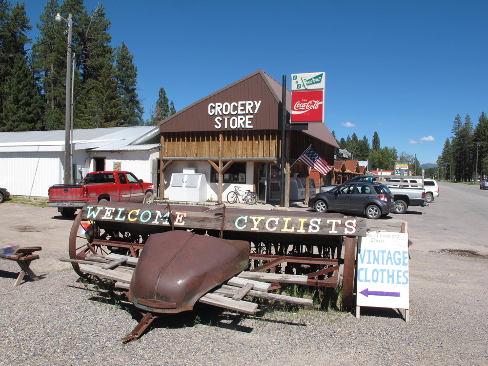
The town prize however, must go to Ovando, Montana. You can ride through it in 30 seconds, it’s that big. What’s far bigger is their enthusiasm for welcoming and catering to bike tourers. There is a big sign outlining all the amenities for cyclists, including a bar, café, a tepee to camp in, power strips to feely recharge your technology, and a fly fishing shop stocking spare bike parts and camping essentials – like camping gas. Take note, Canadian towns!
When we set off, we weren’t sure what our rate of progress would be and where we would end up in the allotted time. Progress exceeded expectations and the finish line kept moving south, keeping my wife on edge as to where she was going to be travelling to for the pickup rendezvous. A stiff tailwind was helping us along, and we realized that Helena was within our reach if we put in a bit of extra effort over a couple of days. Our last day on the route reminded us that stuff happens, and be prepared. We missed a key turn and were rewarded with a couple of hours extra riding off route, with a bonus of two extra crossings of the continental divide on the coldest day we had experienced (complete with a few snowflakes), while figuring our way out of a maze of trails, and then a 2 inch nail provided the only flat tire of the trip an hour out of Helena.
However we rolled into town before dark, celebrated with a cold beverage, and reflected on what a truly fabulous couple of weeks it had been. The riding was easier than expected, the scenery was ever changing and interesting, the weather was generally kind, and we were simultaneously tired and refreshed, and eager to do another section, or even the same one again. It was that good.
Equipment
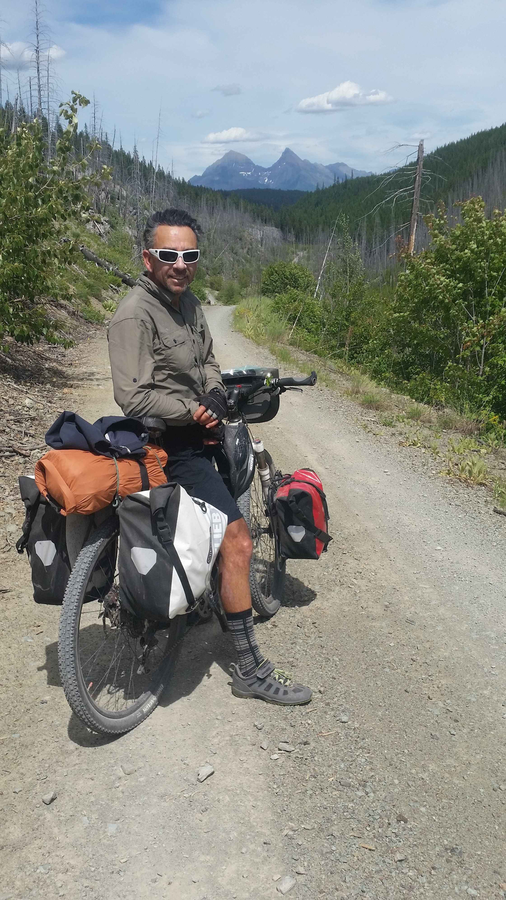
There is a lot of advice, information and opinion about what rig is suitable for this route. It may depend on what you have and what your experience and preference is. As far as a bike goes, you can do this route on a fully rigid gravel bike or a full suspension mountain bike, or some variation of the two. We are old school tourers who like rack and panniers, which we used. No issue at all with this and a perfectly fine choice as our focus was comfort not speed. We encountered other tourers using full rack and panniers, trailers or bikepacking bags. Those bikepackers travelling light were envious of the quantity and quality of the food we produced out of our panniers, which they didn’t have room to carry. Gotta eat well to ride well!
Our respective setups:
- Gary Fisher 29er hardtail mountain bike with a now outdated but eminently suitable 3 x 9 drivetrain; front and rear Axiom racks with front and rear Ortlieb Panniers; handlebar bag.
- Otso Warakin gravel bike running 27.5 mountain bike wheels and a 2 x 10 drivetrain (26/36 chainrings and 11-36 cassette), set up with an Axiom rear rack and ancient panniers, locally made BroadFork custom framebag, 2 x Revelate Designs feedbags, Lone Peak Designs handlebar bag, Camelbak Mule hydration pack.
We both used Maxxis Crossmark tires. One set up was tubes, one was tubeless.
Bike Fit
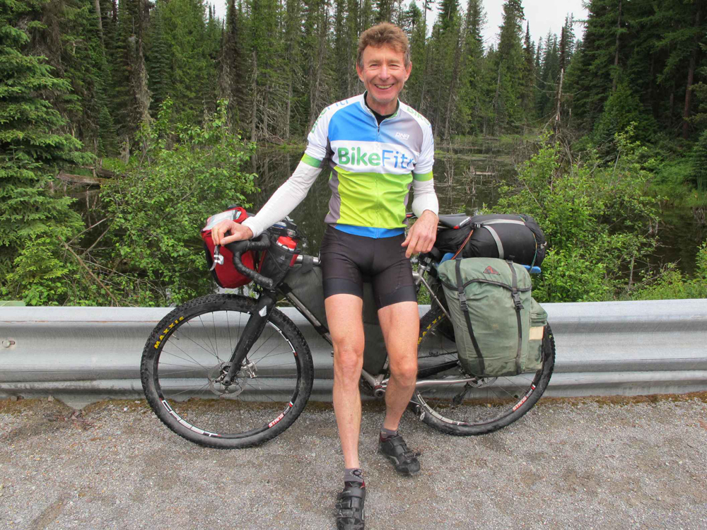
As a bike fitter I had an obvious interest in being comfortable and preventing cycling injuries during this trip. To this end I used a few of the products I recommend and sell including G8 2620 insoles, BikeFit SPD wedged cleats, Prologo saddle, and a Redshift Shockstop suspension stem. All worked out well.
Maps and Information
Cycling the Great Divide by Michael McCoy, published by Mountaineers Books, 2013. Available at adventurecycling.org
Great Divide Mountain Bike Route, Jasper, AB to Antelope Wells, NM, 7 Map Set (3083.8 mi.) overview and individual sections. Available from adventurecycling.org
John Higgins is a bike fitter, and owner of BikeFitr and Fit Kit Systems in Utah. He is a retailer for some of the products mentioned, but is not sponsored by any brands. His only sponsor is his wife. The trip took place June 20th to July 3rd, 2018. Contact john@bikefitr if you want any more details or trail beta from this trip.




Thank you for the account of your trip. Must get round to it. Bug first the Badger Divide!
Comments are closed.