By Don Scheese — In The Way to Rainy Mountain, N. Scott Momaday, a Native American writer of Kiowa ancestry, writes of returning to his ancestral homeland on the Great Plains. “A dark mist lay over the Black Hills, and the land was like iron. At the top of a ridge I caught sight of Devil’s Tower upthrust against the gray sky as if in the birth of time the core of the earth had broken through its crust and the motion of the world was begun. There are things in nature that engender an awful quiet in the heart of man; Devil’s Tower is one of them” (italics mine).
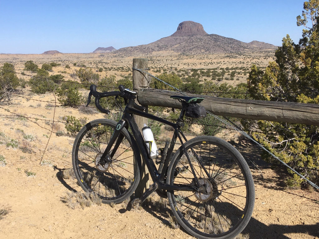
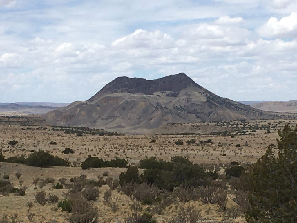
If you have ever driven highway U.S. 550 between Albuquerque and Durango, you could not help but have noticed off to the southwest a prominent volcanic peak rising from the high desert floor. That peak is Cabezon, Spanish for “Big Head,” and Cabezon is the Devil’s Tower of northwestern New Mexico. Towering almost 2000’ above the surrounding terrain, topping out at 7775’ above sea level, Cabezon is the tallest of fifty-some volcanic plugs protruding above the Rio Puerco valley, which in the 1800s was once a thriving Hispanic farming community. For thousands of years “Black Rock, “ as the Navajo refer to it, has functioned as a navigational landmark for travelers and residents.
I can see Cabezon from our house 40 miles distant, and have long been mesmerized by its hulking presence. So, one balmy spring day I headed out with the plan of paying homage to the peak by riding around it, figuring it would be around 30 miles of rolling desert gravel and dirt roads, through land owned by the BLM and private ranchers. Beautifully desolate country, where the Chihuahuan Desert meets the Colorado Plateau Province.
The drive to where I planned to start the ride took about an hour. I parked the car at the intersection of BLM roads 1113 and 1114, and headed off to the north/northwest in a counterclockwise direction, loaded with Camelbak, water bottles, spare tubes, and bars and fruit chews. A light northwesterly breeze kept the early morning temperatures nice and cool, and fair-weather cumulous clouds filled the sky.
What struck me at the start of the ride, and throughout the circumnavigation of Cabezon Peak, was the absolute quiet—no sound of motor vehicles or people talking, the sheer absence of human-caused noise. Except for the sound of my tires rolling across the smooth hard-packed dirt and gravel road, the only other sounds I could hear were the occasional chittering of a rock wren and the soft whoosh of wind across the desert landscape. I found this predominance of natural sound intoxicating.
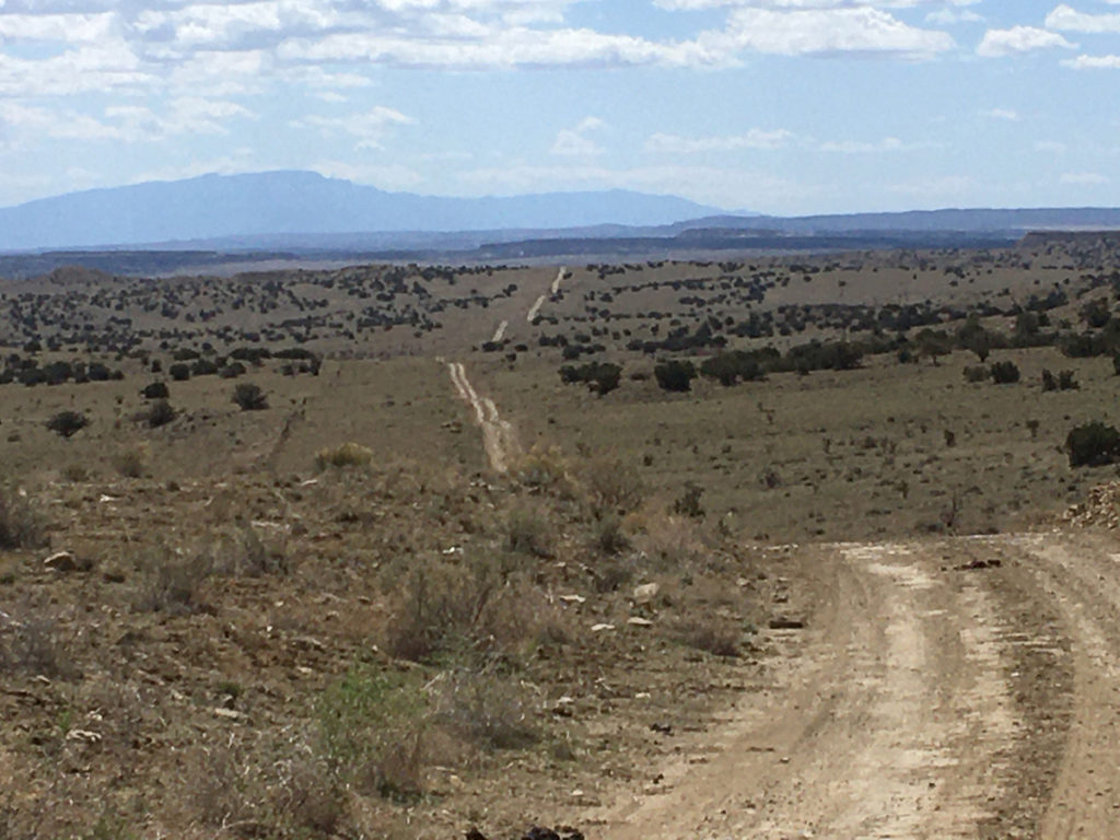
The start of the ride lay along a rolling spine separating Cabezon, but a few air miles distant, from the desert floor sloping eastward toward the Nacimiento Range. On either side of the road brown sandstone slabs protruded like the spines of a stegosaurus, the harder rimrock still in the process of weathering away, and it was great fun to ride this roller-coaster along the crest of the ridge. Eventually I topped out on the mesa top towards the junction of Pipeline Road, so named for the underground gas conduit connecting the oil fields of the San Juan Basin to the Albuquerque metro area and points southeast all the way to Texas. It was then an easy coast down to the dry crossing of the Rio Puerco, then uphill a bit to the outskirts of the village of San Luis. To the north a long low mesa formed the immediate horizon, atop which ran the Continental Divide National Scenic Trail—a geographical divide delineating major watersheds of the West.
A sharp turn to the southwest, on a wider, more gravelly road, followed, and Cabezon rose all the more impressively from the lower desert floor. The peak was formed when molten lava oozed out to the earth’s surface through older sedimentary layers that had accumulated hundreds of millions of years ago when this area was covered by an ancient sea, followed by hundreds of millions of years of erosion, slowly exposing the basalt volcanic columns.
The Navajo tell a different story of the peak’s genesis. According to their legend the sacred peak of Mt. Taylor to the southwest is the body of a giant slain by their heroic figures, the Twin War Gods. The head of the giant’s body rolled off and became Cabezon Peak, and the lava flows of the area are the congealed blood of the slain giant.
Now I was on a section of the Great Divide Bike Route, the 3000-some mile track from Jasper, Canada, to Antelope Wells on the New Mexico-Mexico border. But only briefly, as I took the road less traveled by at the next junction, past the ghost town of Cabezon and across the Rio Puerco again, choked with tamarisk and dry as a bone, one of countless “seasonal rivers” in the arid Southwest. Then it was a long gradual trundle up to the top of the next divide, where I found myself sandwiched between volcanic necks: the brown-layered Cerro Cuate to the west, the Shiprock-like form of Cerro Chato to the south, and immediately due east, the Gibraltar of northwestern New Mexico, Cabezon Peak.
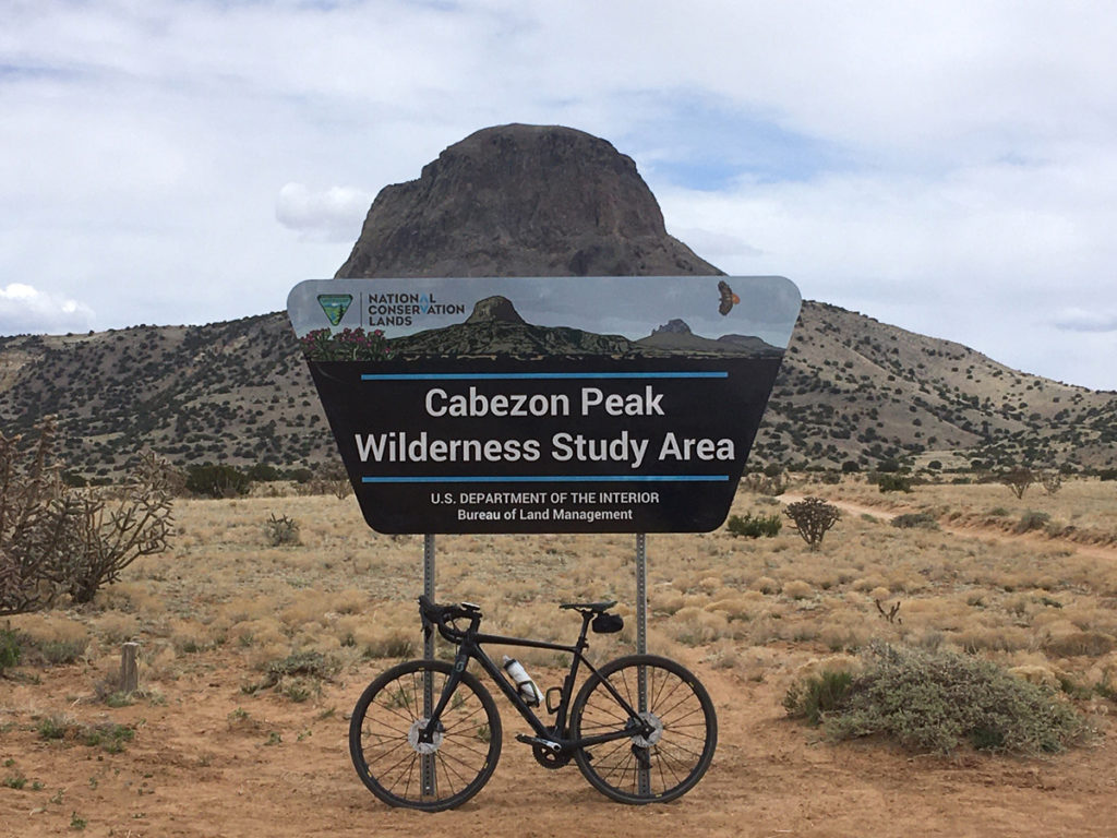
A BLM sign indicated that I was on the western edge of the Cabezon Wilderness Study Area, an 8000-acre preserve of sorts encompassing the immediate area around the peak. A spur road headed off towards the peak and I followed it to the base of Cabezon where a trail register and a few fire rings dotted the ground. The peak looked impregnable, but a brochure in the register mentioned there was a route to the top, a 2.5 mile roundtrip hike and climb of almost 2000 feet. Another time, perhaps ….
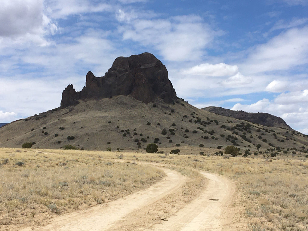
After refueling for a bit, I continued south, the road plunging down into the Abra de los Cerros (the Cove of the Hills), revealing fine views of a number of volcanic necks throughout the Rio Puerco valley, jutting like goosenecks above the desert floor. Past Cerro Chato—past Cerro de Santa Clara—past Cerro de Guadalupe…to the bottom of the drainage, where I took a hard left eastward at another road junction to begin the long steady climb up Canon del Camino. I passed more cow-burnt landscape dotted with juniper and pinyon pines, with some of the latter robustly thriving, while others stood desiccated and needle-less, weather-worn limbs glistening like the bones in an ossuary. The dead pines were apparently the victims of the Mega-Drought the Southwest is currently suffering from. Why do some survive and others not? The Darwinian struggle and the mystery of existence, survival, and death….
A lone vulture floated low over the terrain, making me think of Edward Abbey, who frequently expressed a wish to be reincarnated as a vulture. “Howdy Ed,” I said aloud, breaking the silence. In his most famous work, Desert Solitaire, Abbey tried to articulate the allure of the desert by writing, “The desert wears a veil of mystery. Motionless and silent it evokes in us an elusive hint of something unknown, unknowable, about to be revealed. There is something about the desert that the human sensibility cannot assimilate, or so far has not been assimilated.”
The pyramid-like hill of Cerro Cochino, and the long dark form of juniper-covered Mesa Prieta, loomed immediately to my right as I dropped into my lowest gears and huffed and puffed my way up the steep inclines. Back on top, arriving at the junction where I had begun the ride, 24 miles and 1400’ of ascent later, I could see to the distant south the high dark profile of the Sandias … my Home Mt Range. Turtle Mountain, according to the local Puebloan tribes. How satisfying are Long Views, Distant Horizons, I thought. For 25 years I lived in exile in the Midwest, where a ‘long view’ was but a few miles off….to hell with a ‘prairie perspective,’ I decided—much better, much more inspirational, are the far-off vistas of the American West.
It is a Cyclist’s Truism that the earlier you ride in the day, the lighter the wind, the fewer the vehicles, and the more enjoyable the experience will be. During the entire 24-mile loop I met with only one vehicle, an Hispanic rancher in a battered Nissan pickup who motioned to me in passing if I needed any agua. No gracias, I said.
I had been gone only a few hours, but somehow the ride through the backcountry of Cabezon had seemed much longer, deliciously longer—as if I had experienced a different sense of time while cycling through the solitary silence. Desert Time.
And above it all loomed the dark hulking shape of Cabezon, engendering an awful quiet in the hearts of all who pass by.
Don “Seldom Seen” Scheese lives and rides in New Mexico, always in search of new adventurous routes, especially on gravel roads.





Sounds like a great ride. Will have to try it when it warms up again. I learned English reading Desert Solitaire as I was then also visiting the SW. Very pertinent. Great article. It seems a place like Cabezon should be visited by walking or biking. Thank you.
Comments are closed.