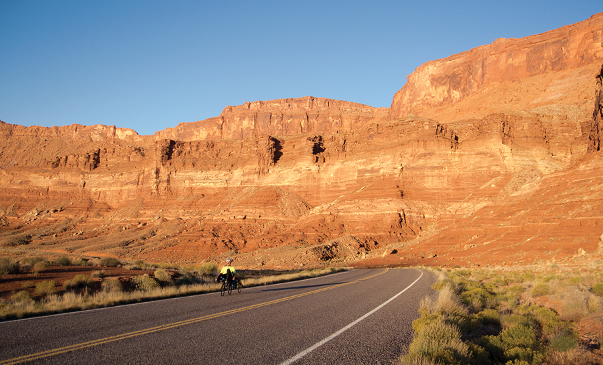
A Bicycle Tour Around the Canyonlands National Park
By Martin Neunzert
Whooosh. A car passes at 70 miles per hour. Ten minutes go by. Whooosh. Another car passes at 75 miles per hour. From where I’m sitting beside the highway, I see faces inside, looking at me as if I’m some sort of alien. Twenty minutes. Whoosh. I wave, but get no response. The first nail in the coffin of interpersonal interactions must surely have been enclosed cars (later came television and, finally, Twitbook).
How did I come to be sitting in the middle of the Burr Desert, perhaps 20 miles south of Hanksville, in two inches of shade from the pole of a stop sign next to a pile of pea-gravel destined for chip-sealing Utah Highway 24? This tour, of course, had its beginnings in a completely different world: Yellowstone. In 2004, I cycled around the Teton Range, from Jackson through Yellowstone National Park and eastern Idaho and back to Jackson. At about 300 miles, I found this to be a very comfortable distance for a nine-day trip. I started looking for similar routes, and soon found a grand loop in southeastern Utah. I was completely familiar with the area, having spent more than my share of time hiking and photographing in the canyon country. Naturally, I had somehow envisioned a springtime trip, but here I was, in the middle of October, due to crazy work demands.
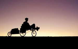
Two weeks before the start of the trip, while lifting my bike onto the roof rack for a check-out ride, I noticed one of the front brake braze-ons had snapped off. Yikes! With very few options, I wondered if it would be smart to do the tour with only one brake. Would you? The hacks at my local bike shop sold me a BMX caliper brake which looked like it would fit, but the cable would have to be creatively routed around the chain, and they knew there was no way their lawyers were going to let them touch that installation! It was all fine, actually, except for two minor issues: There was a little interference between the cable and the chain when turning right, and the braking force was about half of that of the original vee-brake. And one of the caliper arms was so poorly formed that I had to grind the pad on that side to get the correct angle, not wanting to snap the arm off trying to bend it into the correct position.
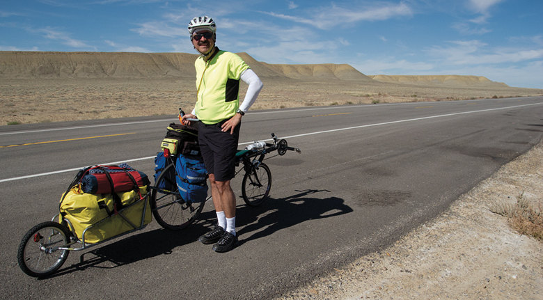
On the bright side, I now had a perfectly practical reason for going counterclockwise around the Canyonlands: Only left turns (although, technically, it is longer that way)! Besides, all the boring bits would be done first. I figured I could use the front brake for all the stops I could predict, say, for times when I had more than 200 yards to react, and the back brake for all panic stops. I knew I could learn the overall braking response of the loaded bike and trailer long before I got to the 8% grade dropping down to Lake Powell, and I promised myself I would walk down that grade if I had to, provided I could stop in time.
If you have ever undertaken a trip like this, you know one of the hardest logistical challenges can be finding a suitable place to park your car while cycling. Unfortunately, in these days, seemingly abandoned vehicles are treated with suspicion. Through Warmshowers.org, I found Teri Ann Tibbetts, Moab artist, crazed cyclist and overly-generous person. She was happy to let me park my truck by the chicken coop, after we moved a disused lawn tractor.
A French couple was staying with her for a few days, on their tour of our country on an awesome expedition tandem. They had the coolest fiberglass bubble-shaped trailer I had ever seen (lightweight and waterproof). After they described their upcoming route past Natural Bridges National Monument and down to Monument Valley, I cautioned them about the Moki Dugway, a series of gravel switchbacks dropping off the end of the world. “No problem,” they said, “We rode up the Shafer Trail a few days ago.” Suitably humbled, I headed north, first through the backstreets of Moab, then along the great new bike trail, past Arches National Park and up to the wonderful country around Crescent Junction.

I regard the region from Crescent Junction through Green River to Hanksville and beyond as “hot stinking desert,” suitable only for paving with photovoltaic panels. Of course, that’s not strictly true, and it really was a pleasant day. I got a little warm on the hills due to a slight tailwind, but soon had the opportunity to start playing one of my favorite games: “Hey, Ya Lost Yer…” As in “Hey, ya lost yer cute little Channellock pliers,” “Hey, ya lost yer hand-tooled wallet,” “Hey, ya lost yer rusty pair of Channellock pliers,” “Hey, ya lost yer nice long NRS raft strap,” and “Hey, ya lost yer perfectly new 3/4-inch combination wrench.” That’s a lot of extra weight to haul around for the next week, so I stashed everything under a bridge to be picked up later (I would have to drive this section to get back to my home in northern Utah).
No matter how you slice it, there’s about six miles of I-70 you have to ride on. Everything went smoothly for me to start with; the wide shoulder seemed just made for bikes, and most of the truckers were courteous enough to give me plenty of room. I chose to continue another 12 miles or so on the freeway past Exit 175; the old highway from here to Green River contains about two miles of gravel and many more miles of disintegrating pavement that may as well be gravel. Then I had a flat, caused by a little needle of wire. Then another. Then another. The tiny wires from the steel belts of shredded truck tires were like riding on staples. Guess how many of the dozens of passing SUVs with red/black/white mountain bikes on top stopped to help? I certainly deserved the Cheetos Puffs and Strawberry Lemonade Powerade at the first convenience store in Green River.
I found Green River State Park a wonderful place to camp, nestled between 45-foot motor homes. Showers are part of the deal! The weather was so nice, I only set up my tent as a courtesy to the other campers so they wouldn’t have to see me changing my—uh, well—socks.
The next morning I took off early, as I wanted to get to the Valley of the Gobs. A few miles west of Green River, I crossed the freeway, jumped the fence and picked up the old highway. For the most part, there are more weeds than asphalt, but it would provide a good venue for your nude cycling adventures. The descent through Jessie’s Twist brings one into a totally different kind of desert, and soon I was back on Highway 24 heading south.
“Hey, ya lost yer bra. And panties.”
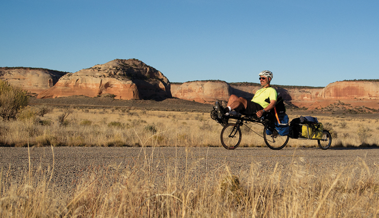
It soon warmed up, and it was only the thought of a shower at Goblin Valley State Park that keep me pushing on. Naturally, the road takes one to the top of the tallest hill around before plunging down to the park. But, just as naturally, the campground was full and they wouldn’t let me take a shower. The nice woman at the desk was certainly within the top ten most beautiful I’d ever met, but she had a heart of ice. Flashing perfect teeth, she happily directly me to what appeared to be an irrigation valve where I filled my bottles with rusty water. I wobbled back to some dusty yellow hills and slept in a ravine, under millions of stars.
The next morning, I cruised easily to Hanksville, after grinding back to the top of the tallest hill around. I nearly panicked in the first convenience store as they did not have any tortillas. But they directed me to the Bull Mountain Market, where they had everything but patch kits and doughnuts. My plan was to see if I could bypass Hite (personal reasons) and get all the way to Natural Bridges National Monument. I left town with nine quarts of water.
“Hey, ya lost yer kid’s PFD.”
Yet another world is entered when one leaves the Burr Desert and descends into North Wash. The sandstone cliffs start to rise, first the Navajo and later the Wingate. Some of the cottonwoods were still green, but most were wonderfully yellow. I declined a covered picnic table at Hog Wash—I mean, Hog Springs—in favor of a bar of shifting yet comfortable sand in narrow Marinus Canyon. There was enough running water in the main canyon to wash some of the sweat-salt off. Sleeping out again, the stars wheeled by in the strip of sky that I could see; it was calm and oh, so unbelievably quiet.
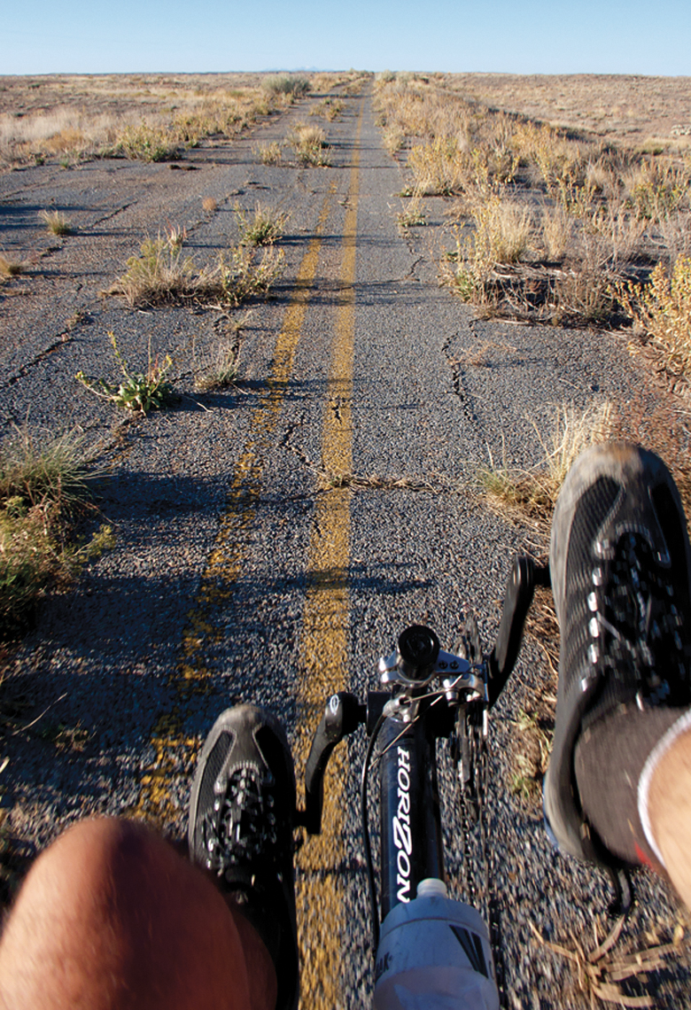
To get to Natural Bridges in daylight, I knew I had to start a few hours before dawn. Just for future reference, a half moon is more than enough light to ride with, provided the road is truly deserted. I felt comfortable enough with my rig to descend the eight-percenter without incident, although my left forearm was cramping a bit toward the bottom. Dawn caught me as I crossed the Dirty Devil River, the lowest point of the loop at about 3,700 feet.
From the bridge over the Colorado River, it is a sweet 3,000+ foot climb to Natural Bridges, passing such local landmarks as Jacob’s Chair and the Cheesebox. I talked briefly with a guy (curiously dressed entirely in black) cycling toward Death Valley, by way of Capitol Reef, Boulder Mountain, Escalante, Zion National Park and Las Vegas. He was looking for a bike shop because he had nearly become stranded the day before when his chain broke, then he had spent half an hour looking for one half of his spare link when he lost control of the chain ends and the spring force from the derailleur flipped it into the dusty gravel.
“Hey, ya lost yer twelve-inch butcher knife.”
Even though it never got very hot, I still sort of ran into the wall near wonderful Fry Canyon. So I packed down a little “solid rocket fuel”: An equal mixture of butter and brown sugar, reputed to be NOLS’s solution to hypothermia. Awesome. Recharged, I plummeted to Natural Bridges an hour before sunset, and got the last camp spot. Who knows what adventure would have transpired had I had to go back outside the park to camp? I was surprised to find the restrooms at the visitor center unlocked, so I splashed around in there for a while. There’s a five-gallon limit on the tap outside, but no restrictions inside…
By pushing hard the last couple of days, I had earned a rest day. So I hiked down to Sipapu Bridge and into one of the side canyons. On the big list of shoes to be avoided for canyoneering, cleated cycling shoes hold the top position.
Another dawn start got me easily to Salvation Knoll, the high point of the trip at 7,110 feet. I should have slept in, as I shivered my way down the ten-mile, 2,000+ foot descent into Comb Wash. The climb over Comb Ridge is fun enough, and as a reward, you get to grind out of Zeke’s Hole. “Hey, ya lost yer five-inch diameter quarter-inch thick steel washer.” There’s a hundred dollars for anyone who can accurately describe the boulder it’s sitting on. I certainly deserved the Cheetos Puffs and Strawberry Lemonade Powerade at Clark’s Market in Blanding.
The Blanding Visitor Center turned out to be a great place to check my e-mail and fill up on water. I had hoped the campground at Windwhistle Rock would be a practical source of water between Monticello and Hole N” the Rock, but a check of the BLM’s website said the water supply had been turned off for the season. No matter, I now knew I could go at least 30 hours, maybe more if I paid a little attention. I camped that night in a weird but secluded pit near Recapture Reservoir, and listened to the trucks growl up the grade all night.
“Hey, ya lost yer trendy neon green sunglasses.”
By midday the next day, I was in Monticello, which was my first opportunity to get a gut-busting cheeseburger. The fries at the R&F Restaurant are incredible, even if they are synthetic. Shortly after that, next to the llama farm, at the top of steep Peter’s Canyon, I talked to a family on a ten-month tour. Pretty awesome, unless you are one of their small kids, stuck in a trailer all day. Everyone is tougher than I am. They had talked to the French couple in Rangley, which, we agreed, was about as far from France as could be imagined.
Near Church Rock, I came across another hard-man (also dressed entirely in black), cycling from Alaska to Patagonia. As we talked, it became apparent we had conversed by e-mail two weeks ago, through Warmshowers, when he was trapped at Bear Lake by an early snowstorm. Obviously, he made good time through Salt Lake and over Soldier Summit. Hope the surfing’s good for you in Baja (dude).
Turned out the water was still on at Windwhistle Campground, and I was lucky to get a camp spot. Who could have predicted both UEA and the start of deer season? So I used some of my hard-carried water to wash up, and re-filled that amount, just to see if I could have made it. Later, the kindly gentleman from the next site angled over to borrow my lighter, and to ask about recumbents. He had done quite a bit of cycling in previous years in Minnesota and North Dakota, and admitted that the pain from cycling was reducing his pleasure from cycling.
It’s not very far from Windwhistle Rock to Moab, but because of the unrelenting lack of bad luck, I was now faced with finishing the tour a day early if I persisted in maintaining my pace. So the next day I knocked off a staggering ten miles, all the way to Hook and Ladder Wash. There, after pushing my bike hundreds of yards up a sandy wash, I spent the afternoon hiking around below the stunning sandstone cliffs.
The next morning I was a little surprised to find tiny crystals of ice in the threads of my water bottles, so once the sun crested the hill, I finished the roller-coaster hills to Kane Springs Rest Area, where I filled my bottles one last time, with some of the best tasting water you’re likely to find anywhere. I used Zen-based navigation to get back to Teri Ann’s, as I really hadn’t made any mental notes about the critical turns. She was very excited to hear my tales, and even more so to learn about my recumbent. Perhaps another seed has been planted.
Teri Ann suggested, rather than wasting my time with Cheetos Puffs and Strawberry Lemonade Powerade, I “recharge” at Milt’s, a classic Moab establishment which I wasn’t familiar with, but will certainly visit again. While waiting for my double bacon cheeseburger, I amused to see the grill-man, when crunched a little for time, simply put strips of bacon into the deep-fryer. That calorie-loading easily got me back to Ogden by dark.
Much later, I located the owner of the wallet, and got it back to him. And even later, checking the maps, I discovered the loop I had done had zero net elevation gain and loss. Curious indeed!


