By David Collins — Ride 100 Miles or More in One Day – Entry Points in Utah. Rides Include Some Miles in Border State(s).
[Editor’s note: This article is the third part of a series, to see the first two, check out the 2019 March and July issues.]
Utah and her neighbor states are blessed with iconic geography and interesting diversions. Although these rides include stunning scenery, they often feature hidden gems and forgotten highways and byways – a cyclist’s dream – filled with unforgettable imagery, points of historical interest and quirky pit-stops.
Extended shoulder seasons are usually the best time of year to ride most of these routes, but depending on your skills and equipment, you might be able to ride nearly year-round. Be weather aware, riding conditions can swiftly change.

Excursions and explorations are part of the fun of unsupported bicycle touring at your own pace. Mileage estimates are approximate and may vary depending on your tracking system and whims of the ride. Be sure to tell someone your plans and allow them to track your location using a smartphone or other device.
Solo or unsupported distance cycling often presents potentially dangerous situations related to terrain, weather, equipment, traffic, navigation and mental awareness. Even experienced cyclists must plan carefully and use wise judgment to successfully mitigate inherent risks of the sport or terminate a ride before it turns injurious or deadly. If you are new to the sport, or have never ridden a bicycle 100 miles in a single day, learn the ropes with a seasoned buddy or local riding club before giving one of these routes a go.
Make sure to check maps, plan your route and check local road conditions before you go. As with any ride, be aware of your surroundings and of roadway traffic.
Time to fill water bottles, stuff gear bags, click in and start pedaling Utah’s great border century rides.
Arizona
Mountains to Desert; Utah and Arizona (with a dash of Nevada at the end)
Route: Enterprise, UT; Veyo, UT; St. George, UT; Snow Canyon State Park, UT; Ivins ,UT, Shivwits, UT; Littlefield, AZ, Mesquite, NV. Begin in Enterprise, south on 18 through Veyo to St. George, west on W. Snow Canyon Parkway and north on Snow Canyon Drive to its terminus (through Snow Canyon State Park). Return the same way out of the park and ride through Ivins and turn West on W. Highway 91, South on Old Highway 91 through Littlefield AZ to Mesquite NV.
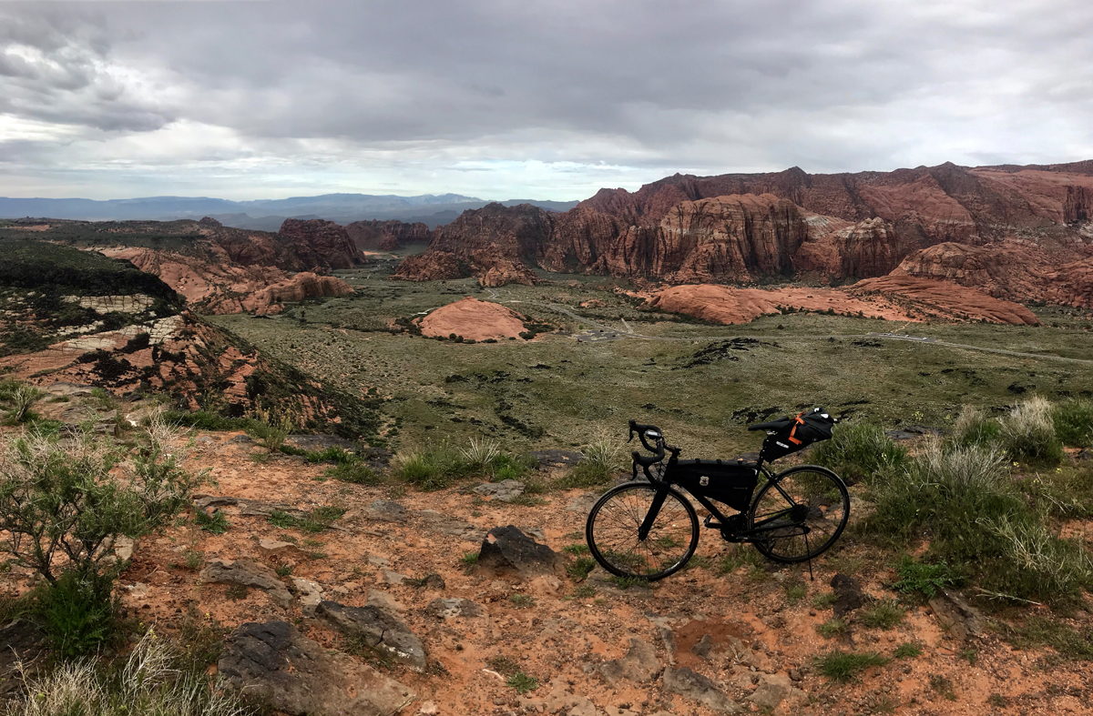
Terrain: Mountain passes, rural farmlands, remote Native American lands, long steady climbs and descents, small towns and villages.
What to See: Just south of Enterprise you’ll see signs for the Mountain Meadows Massacre memorial site, be sure to take a few minutes to walk the short path up to the overlook and read about the 1857 tragedy; the rim of Snow Canyon, turn west at the road sign and take the short gravel road to the overlook; a stunning detour through Snow Canyon (including a memorable 1,000 ft. four mile climb); a show stopping curtain of red mountains, best viewed in the Shivwits Paiute Indian Reservation by turning around often during the long climb toward Arizona border; miles of Joshua trees and desert sagebrush throughout much of the long descent into Littlefield, Beaver Dam Mountains; dry wash beds of various creeks and rivers; Virgin River bottoms.
Selfies and Photo Ops: Mountain Meadows Massacre overlook; Snow Canyon from the rim and through the valley; Veyo Pies storefront; historic pioneer buildings and museum in Santa Clara (a brief detour you may want to explore if you are into regional history); Bulldog Pass sign; long road pointed northward toward the wall of red mountains in the Shivwits Paiute Indian Reservation; Scenic Joshua Tree Byway sign with miles of Joshua trees in the background; Beaver Dam Wash National Conservation Area; Virgin River bottoms overlook just outside of Mesquite.
Wildlife: Birds of prey, California condors, Mexican spotted owls, mountain lions, mule deer, fox, coyotes, badgers, porcupines, snakes, jackrabbits, raccoons, lizards, desert tortoise.
Best Post-Ride Eats: Check into CasaBlanca Resort and Casino, clean up and pay a visit to Katherine’s of CasaBlanca (will reopen May 15, 2020). USDA Dry Aged Prime beef from Stockyards in Chicago awaits, along with Florida stone crab flown in from the keys (when in season). Get things started with fresh Oysters Rockefeller. For the steak, get the strip. Wrap things up with Bananas Foster and a long night’s sleep in your nicely chilled room, a luxury after so many miles in the sun.
Still Have Legs, Lungs and Sunlight? Just past Shivwits, turn north on Gunlock Road and ride to Veyo and back (29 miles). A fabulous ride through sometimes lush farmland, past Gunlock reservoir and a lovely climb from the river bottoms up to another rural shelf and into Veyo. Be sure to stop by Veyo Pies again (surely you dropped in the first time through Veyo) and eat some of their world famous pie, I recommend the strawberry rhubarb. Pie and barbeque in a tiny roadside joint? The proprietors must have a spot or two of cycling in their souls.
Note: This ride begins in moderate mountain terrain and finishes in the desertscapes of northeastern Arizona, with and a handful of miles in Nevada. Pay careful attention to weather forecasts and be properly armed with sufficient hydration and nutrition. Also, be aware of flashfloods – water levels on local roadways can sometimes rise to dangerous levels in minutes of even seconds.
Nevada
Go West! Utah and Nevada
Route: Snowville, UT to Montello, NV (one way). From Snowville, take N 18575 N (a gravel frontage road) west for a couple of miles until it joins the paved Highway 30. Ride west on Highway 30 until you reach Montello. 106 miles
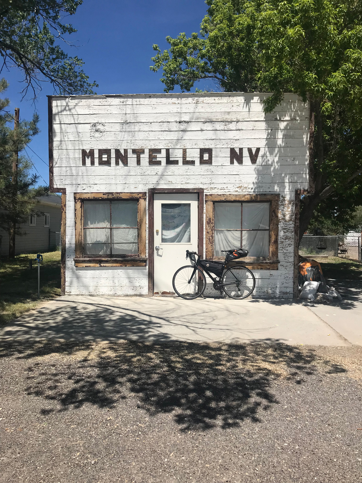
Terrain: Periodic patchwork of sage brush, grassland and cultivated farmland, rivers, creeks, expansive valleys lined by plateaus, risers, and alpine mountains.
What to See: Long stretches of road through valleys you’ll want to return to with a cinematographer to try and capture the essence of the place; open cattle ranges; alpine peaks on the horizon; northwest finger of the Great Salt Lake (including salt flats and watershed boundaries); skyline view of Antelope Island from the rarely seen or photographed west side; Pilot Peak (often snowcapped through much of the summer).
Selfies and Photo Ops: Next Services 102 miles sign; black metal silhouette of wolf howling on top of mountain butte; 27 Ranch gate; Coldwater Ranch gate; Welcome to Park Valley and nearby Park Valley Cemetery gate; Montello Rd. sign (a faded little wooden sign about a mile or two before town; Leenaz She Cave and bottle garden; several road-to-infinity backdrops along the way; old west façade whitewashed building with distinctive MONTELLO NV letters above the door.
Wildlife: Antelope, rabbits, coons, deer and elk, snakes and lizards, birds of prey, waterfowl, and buzzards.
Best Post-Ride Eats: Montello is charming but tiny and the kitchen in the bar never seems to be open, but there is one reliable food option: the Montello Gas and Grocery, serving soda pop, hot coffee, cold beer and snacks. Get some beef jerky, Frosted Flakes, cold milk and a loaf of white bread and mustard so you can wrap a few sticks of jerky dabbed with mustard to go with Tony the Tiger’s treat. Or, tough out 50 more miles to Wendover, Nevada where you’ll find all the casino food you can handle. If you do this ride in reverse and land in Snowville, there is a much better choice for dinner. Step into the Ranch House Diner, find your way back to a booth by the antique saddles, next to the fireplace and underneath the trophy elk head with a unique starboard antler. Then dive into The Trail Boss (a 16 oz rib eye – “hand cut, marinated and never frozen”). For a smaller serving try their Rattle Steak Sandwich and fixins – a tasty supper.
Still have Legs, Lungs and Sunlight? Fuel up and turn your wheels towards Wendover, about 50 miles down the road on the Utah border. After a nosh at one of the fern bars, check into a small-town casino, store your bike, take a hot shower and try your luck at the roulette wheel.
Notes:
This is a remote ride and cellular service is weak or nonexistent during the last 20-30 miles until you reach Montello. In addition to your normal tools and supplies, be sure to plan ahead by taking sufficient food and hydration since there are no refueling stops along the way.
Also, believe it or not, Montello has accommodations. The Pilot Motel features about a dozen clean rooms with AC and Free TV. Rooms can be booked through Montello Gas and Grocery. Call ahead though, you can’t check in past 7:00 PM on weekdays or 5:00 PM on weekends (hours may change based on whims of the proprietor). Why not stay overnight and turn your century ride into a back-to-backer by returning to Snowville the next day?
Colorado
Dinosaur Drive; Utah and Colorado
Route: Roosevelt UT; Vernal UT; Jensen UT; Dinosaur, CO; Rangely, CO. (with a detour through Dinosaur National Monument UT). From Roosevelt, east on Highway 191 to Vernal, east on Highway 40 to Jensen, north on S 9500 E to Quarry Entrance Road which takes you into Dinosaur National Monument (UT), take the seven-mile road in the park and return the way you came – back to Jensen. Continue east on Highway 40 to Dinosaur, CO, then south on Dinosaur Diamond Prehistoric Highway to Rangely CO. 101 miles.
Terrain: Low-grade risers and intermittent flats with arroyo undulations sprinkled throughout.
What to see: Rivers (Uintah, Green, Yampa, Rio Blanco); distant mountains (Uintas, Blue Mountain); Dinosaur National Monument north of Jensen. The seven-mile ride in the park is worth the effort and nominal entry fee and includes stunning views of dramatic cliffs, the Green River and easily accessible ancient Native American petroglyphs and pictographs; big western sky country; Rangely Auto Museum (seasonal hours); Chevron oil country including a few outbuildings littered across the empty valley between Dinosaur and Rangely, active oil pumps, drilling and wells; Rocky Mountain Cannabis store in Dinosaur (if that’s your thing).
Selfies and Photo Ops: Welcome to Roosevelt – Energy Hub of Utah sign on the east side of town; Musket Shot Springs overlook (between Jensen and the Colorado border); Split Mountain and ancient Native American petroglyphs and pictographs in Dinosaur National Monument; the giant dinosaur in the front yard of the town hall in Dinosaur; Rocky Mountain Cannabis sign in Dinosaur; several out buildings and abandoned structures throughout (think ghost town), Rangely School District bald eagle mural on the north side of the building; and Rio Blanco river crossings.
Wildlife: Bald eagles and other birds of prey, buzzards, ducks, geese, pelicans, elk, deer, fox, coyotes, trophy fish, black bears, mountain lions, badgers, porcupines, snakes, jackrabbits, raccoons, mountain goats, pica and other little grounders.
Best Post-Ride Eats: For such a small village, Rangely offers a surprising selection of eating options. After a long ride over the border though, it’s hard to beat the T-Bone Steak Ranchero at El Agave Mexican Restaurant. Ask them to add a few jumbo prawns to go with your hot tortillas, rice and beans that come with the steak and wash it all down with a cold drink from their full-service bar.
Still have Legs, Lungs and Sunlight? Turn north on Highway 191 in Vernal to Steinaker State Park where you can cool off in pristine blue waters and enjoy more sandstone and desert landscapes. (about 15 miles there and back).
Notes: The Welcome to Rangely sign brags: Way Outside of Ordinary. It’s true, it doesn’t take long to realize the ride continually evolves into a uniquely rugged and remote region after you leave Jensen. Bring extra hydration, sun protection and mechanical equipment. Also, consider scheduling your ride to overlap the annual multi-day Northern Ute 4th of July Pow Wow activities (east of Roosevelt at Fort Duchesne) where you’ll find folks from more than 15 states and Canada celebrating Native American cultures with dance, music, food and contests.
Idaho
Plymouth to Pocatello; Utah and Idaho
Route: Plymouth UT; Malad City, ID; through southern Arbon Valley, ID; Pocatello ID. Begin in Plymouth, west on 20800 North Road, pass under Interstate 15, immediate north on Frontage Road, over the UT/ID state line, north on S. Old Highway 191 which turns into S. Main Street in Malad City. West on Idaho Highway 37/38 (which turns into W 2000 S). After riding over the mountain pass and descending into the next valley, turn north on N Arbon Valley Road which becomes Buist Road and then Arbon Valley Highway. Turn east on Mink Creek Road and ride through the mountain pass and into southern Pocatello – finally, north on Bannock Highway into Pocatello. Sound complicated? It’s really not. Take a look at a map and you’ll see it’s an easier route than it may seem from this description. 103 miles.
Terrain: Extended flats and long, low grade climbs through two mountain passes.
What to See: Rural farmlands; sagebrush foothills; mountain passes sometimes loaded with curious wildlife, historic pioneer landmarks and townships, open rangelands, memorable Arbon Valley (from their town website: “The Best Place on Earth”), you might be as surprised as I was to roll through such a picturesque valley that doesn’t seem to have been discovered yet by the hoi polloi. Stretches of winding roads through camping country (and ATV, snowmobiling and hunting and fishing country); historic section of old Pocatello and Idaho State University.
Selfies and Photo Ops: Welcome to Plymouth sign (with historic July 4th rodeo copy); faded Rope Trailers horse trailers mural on defunct building façade in downtown Malad City; road to infinity looking back into Malad City from the rising climb out of town on the west side of the valley; too many spots to mention in Arbon Valley but don’t miss the ghost town like outbuilding that’s barely standing in a drunken lean (on the east side of the road before the Mink Creek turn – can’t miss it); original art deco-ish Chief Theatre sign from 1938 in old Pocatello; the Idaho State University Greek pillars on Red Hill (a Pocatello landmark and I.S.U. icon).
Wildlife: Birds of prey, elk, deer, fox, coyotes, mountain lions, badgers, porcupines, snakes, jackrabbits, raccoons, mink, beavers and ranch dogs (well, they aren’t really wild but they seem to run extra free on parts of this route and are often keen to enthusiastically chase cyclists in anger – so be sure to brush up on your stray dog technique before you go).
Best Post-Ride Eats: A gas station? Although Pocatello is a city of more than 50,000 people, with all the food options you might expect, Cafe Tuscano is located in a gas station and is “pumping out” wonderful post ride bistro fare. Amazing Italian dishes with fresh ingredients and an impressive wine collection (go figure, there’s a terrific Indian restaurant in Logan, Utah built into a gas station too – maybe it’s an idea that’s catching on?). Start with the charcuterie board of meats and cheeses and move right into a well-prepared pan-seared striped sea bass plate with tasty sundried tomato and spinach risotto and roasted portabellas and a pimento green olive tapenade that would make a phone book taste good. Hard to believe such a food stop would be cyclist friendly – but they are indeed.
Still Have Legs, Lungs and Sunlight? Head north out of town on Highway 91 through Chubbuck and into Fort Hall, a township in the Native American reservation of the Shoshone-Bannock Tribes. Be sure to get one of the savory bison burgers at the gas station by the casino (24 miles there and back).
Note: This ride could be titled “Cowboy’s and Indian’s” since the route passes through pioneer and Native American points of interest. Look for historic landmark signs along the way.
Wyoming
The Big Bear Lake Loop; Utah and Wyoming (with a healthy clip of miles in Idaho)
Route: Garden City, UT; Cokeville, WY; Montpelier, ID; Paris, ID; Fish Haven, ID; Garden City, UT (one-way loop). Begin in Garden City, south on Highway 30, north on WY Highway 89, north on WY Highway 30 to Montpelier ID. Take south Highway 89 in Montpelier all the way back to Garden City, UT. 112 Miles
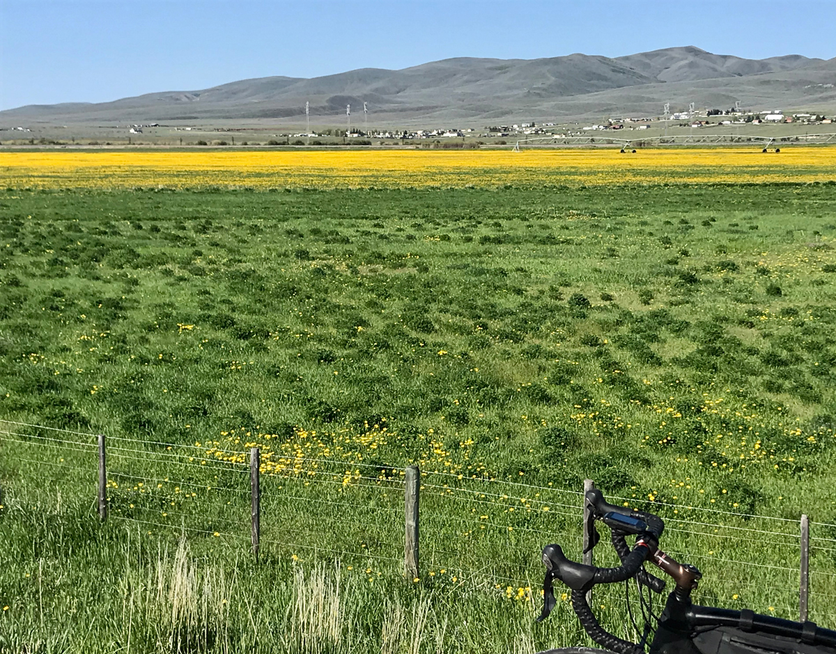
Terrain: Rural flats, two medium mountain passes, lakeside shorelines and historic settlements and villages.
What to See: Distant vistas and repeating mountain ranges layered on the horizon; rural farm towns; ranchlands; barns and out buildings; Bear Lake, a turquoise blue marble plopped down in the middle of a memorable valley, surrounded by alpine mountains; Cokeville National Wildlife Refuge; The Bank of Montpelier, the last standing bank verified to have been robbed by Butch Cassidy; Paris Tabernacle, a Romanesque Revival style red sandstone church built in the late 19th century by early settlers; national historic trails (Oregon Trail and California Trail); site of Pegleg Smith’s Trading Post; old McCauley’s Road, a section of current Highway 30.
Selfies and Photo Ops: Scenic miles along the western and southern shorelines of Bear Lake; Welcome to Cokeville sign on the southern end of town; the vast Cokeville National Wildlife Refuge; Pine Creek Ski Resort sign; entrances and exits of two remote mountain passes; Oregon and California Auto Tour Route signs; Paris Tabernacle, Butch Cassidy Museum in Montpelier; wetlands and ponds; Welcome to Paris sign.
Wildlife: Elk, deer, birds of prey (eagles, owls, hawks, Northern Harriers), Black Terns, Yellow-headed Blackbirds, White-faced Ibis, Black-necked Stilts, buzzards, fox, coyotes, beaver, trophy fish, black bears, badgers, jackrabbits, raccoons and other little grounders.
Best Post-Ride Eats: Cody’s Gastro Garage in Garden City. A converted mechanic’s garage (complete with a couple of hot rods on lifts inside the restaurant). Open year round and a great place to tuck into two or three pounds of wings. Be sure to get the raspberry chipotle sauce for the wings – the area is famous for mountain raspberry farms. BTW: the barbeque chicken quesadillas are the best I know of in Utah. You can’t believe the flavoring dance steps and innovative tortilla treatments they perform on the classic dish.
Still Have Legs, Lungs and Sunlight? It’s a bit of a stretch (and may require another day of riding) but it’s worth noting – you can turn north at the northern apex of the loop and be in Jackson Hole, WY in another 100 miles or so. Also, this ride is called the Big Bear Lake Loop; if you prefer a 50ish mile ride instead, hug the lake’s shoreline all the way around for the Little Bear Lake Loop.
Note: Some roads are closed during winter months and cell coverage may be spotty throughout the ride.
David Collins is a cycling enthusiast and amateur randonneur. Follow him on Instagram @rockypumpkin

