The Kamas Valley Challenge is a 43.0-mile loop that incorporates some popular bicycling roads in the “Wasatch Back” of Summit and Wasatch Counties. The loop follows roads that have been used, on occasion, for the U.S. national road racing championships and the Tour of Utah, and which regularly attract a legion of devoted riders. The ride visits several small communities, of which Kamas, with a population of 1,899 in 2012, is the largest. The loop is challenging in that there are several significant climbs, although the gap between the highest elevation (7,047 feet) and the lowest (6,113 feet) is only 934 feet. The route follows marked state highways primarily, although a couple of diversions are inserted to add a little extra to the experience. Notably, even the state highways are not heavily traveled in this region (the highest volume is along SR 248 west of Kamas, with 7,000 vehicles per day), hence their popularity among cyclists.
 The ride begins at Kamas City Park, located at 100 South & 100 East in Kamas. Kamas is located at the junction of State Routes (SRs) 32 & 248, at the “gateway” to the Uinta Mountains. The city’s name is a reference to an edible bulb, growing in the valley, which was a staple of the Ute and Shoshone tribes who once lived here. The name is also a reference to the landscape: “small, grassy plain.” To get to Kamas, travel along the I-80 freeway to the SR 32 exit. Head south on SR 32 for 16 miles. The city is located 48 miles east of Salt Lake City (via the route just described), and 16 miles east of Park City (via SR 248). One of Kamas’ claims to fame is a cycling tradition: the annual High Uintas Classic, which features an 80-mile road race to Evanston, Wyoming, on a course that climbs to 10,700 feet over Bald Mountain Pass, along SR 150. The current ride does not attempt to tackle the Uintas, though, staying on roads to the north and west of Kamas.
 Start by heading west on 100 South, and then turning right onto Main Street (SR 32). (Please note that this article describes a counterclockwise loop; doing this ride clockwise is equally fine). Heading north on SR 32, leave Kamas after at mile 0.9, and enter Marion at mile 1.2. Marion had a population of 685 in 2010. The town is named for a former LDS Church official, one Francis Marion Lyman (for which Francis, visited later in this ride, is also named). Soon after SR 32 bends left, at mile 4.3, turn right, off of the highway, onto New Lane. Make another, immediate right onto Boulderville Road, and head east, climbing gradually. Cross over Crooked Creek at mile 5.1 – the creek is one of several waterways in Kamas Valley, contributing to one of the more fertile valleys in Utah. The road bends left at mile 5.6 and heads north, becoming 1000 East and continuing to climb. At mile 6.6, 1000 East begins a series of curves mixed in with several short, steep climbs. After bending to the left at mile 7.6, you are now on Pinion Road. Just 0.2 miles later, at the stop sign at mile 7.8, turn left onto Weber Canyon Road.
The Weber River parallels Weber Canyon Road for a stretch – its source is runoff from the adjacent Uinta Mountains. After a gradual downhill, enter Oakley at mile 10.2. Turn right, at the stop sign at mile 10.5, onto SR 32. You have now completed a “reverse-C” shaped diversion from the highway, and are ready to continue along SR 32. Oakley, population 1,524 in 2012, is named merely for the scrub oak that grows in the area. After a gradual uphill, and a sharp bend to the left, at mile 11.0, the highway descends at a 7% grade into the community of Peoa (population 253 in 2010). The name is derived from a native-American term meaning “to marry.” SR 32 bends right at 13.3, followed by a few curves.
At mile 14.3, turn left onto Brown’s Canyon Road. Thus begins a long, almost steady climb from the low point of this ride (6,113 feet), to an elevation of 6,849 feet, followed by a short plunge to the junction with SR 248 (elevation of 6,697 feet), at mile 21.2. Turn left here, onto the highway, and continue to descend. The Jordanelle Reservoir appears on the right at mile 22.3. Jordanelle State Park, which surrounds the mighty reservoir, is best accessed from its opposite side. SR 248 descends rapidly to mile 23.0, and an elevation of 6,324 feet, before kicking upward for a strenuous 2-mile climb. The highway finally crests at 7,047 feet, the high point of this ride, at mile 25.9. There are dramatic overlooks of Jordanelle along the way. From here, the highway descends rapidly toward Kamas.
But wait! One option would be to continue along SR 248 to SR 32 in Kamas; turn left and return to 100 South and City Park to conclude the ride. A longer option, however, extending the ride by about 12 miles (to 43 miles), would be to make a very sharp right onto 200 South, near the base of the SR 248 descent, at mile 30.1 (i.e., before entering Kamas). Turn left onto Lambert Lane at mile 31.3. Follow this road as it bends to the left a couple of times, ultimately heading east. Next, turn right, at mile 32.8, onto Hallam Road and head south. After a curve to the left, the road descends steeply to SR 32. Carefully turn left onto the SR 32, watching for traffic in both directions. Enter Francis (population 1,120 in 2012). Turn right onto Spring Hollow Drive at mile 34.5, adjacent the Uinta Junction Country Store (there was no street sign when I did this ride). After a short, steep descent and climb, at mile 35.0, the road curves to the left, making another steep drop. Turn left onto Lower River Road at the stop sign at mile 35.6. This road winds through a strikingly picturesque, pastoral setting.
At mile 37.8, make a hard left onto SR 35, and make a short climb. Shortly after the highway bends to the left, at mile 40.1, turn right onto Foothill Drive (no street sign when I investigated). Follow Foothill as it bends to the left and right, with Kamas on the horizon. Once in Kamas, amidst its residences, turn left onto 300 South (mile 42.4). Next, turn right onto 100 East. Proceed across 200 South, and continue to City Park (mile 43.0), where the ride ends.
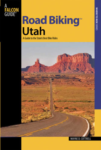
For more rides, see Road Biking Utah (Falcon Guides), written by avid cyclist Wayne Cottrell. Road Biking Utah features descriptions of 40 road bike rides in Utah. The ride lengths range from 14 to 106 miles, and the book’s coverage is statewide: from Wendover to Vernal, and from Bear Lake to St. George to Bluff. Each ride description features information about the suggested start-finish location, length, mileposts, terrain, traffic conditions and, most importantly, sights. The text is rich in detail about each route, including history, folklore, flora, fauna and, of course, scenery.
Wayne Cottrell is a former Utah resident who conducted extensive research while living here – and even after moving – to develop the content for the book.


Are there any wildlife to be concerned with on this course? Is the course paved?
Comments are closed.