The Moapa Valley Ride on Fire is a 50.9-mile out-and-back route, taking the cyclist from Logandale, Nevada to Valley of Fire State Park, and back. While Logandale is in Clark County, of which Las Vegas is the seat, Logandale and the Moapa Valley are worlds away from the hubbub of the Strip. Las Vegans may journey to Logandale every year for the Clark County Fair, and several other events, but the Moapa Valley is generally a quiet alternative, located 55 miles northeast of Vegas, and 35 miles southwest of Mesquite. Take the Overton exit from I-15, and head south on Nevada Highway (NV) 169.
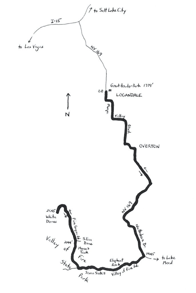
The ride starts at Grant M. Bowler Park in Logandale, located at 3280 North Moapa Valley Boulevard (NV 169). The GPS coordinates are listed at the end of the article. Grant Bowler was a local high school teacher, and director of the Clark County Fair. Head south on NV 169, through the agricultural-ranch community of Logandale. The community was originally named Logan, but the name was changed to avoid confusion with Logan, Utah. South of Logandale, enter the larger, agricultural-ranch community of Overton. NV 169 makes several right-angle bends as it makes its way southeast-ward across the Moapa Valley. South of Overton, the highway passes by the Lost City Museum, which is built on the site of the Pueblo Grande de Nevada, an ancient Anasazi city. By the time Mormon settlers made their way out here, in the 1860s, the Pueblo Anasazi were gone, and had been replaced by the Paiute. The Mormon settlers successfully colonized the valley, transforming it into its current form. The word is that residents who need to excavate, for whatever reason, often uncover ancient Anasazi artifacts. The route is gradually downhill from Logandale (elevation 1,379 feet), though Overton (elevation 1,244 feet).
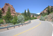
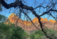
Leave the Logandale-Overton community at mile 8, and enter a mostly barren, desert landscape. You are now on Northshore Road, skirting the edge of Lake Mead National Recreation Area. The road climbs gradually to the Valley of Fire Wash. After crossing the wash, the road climbs at a 4% gradient for one and three-quarter miles, before descending gradually. Leave the Lake Mead environs at mile 14.45 with a right turn onto Valley of Fire Road, which is a Nevada Scenic Byway. Enter the State Park at mile 15. There is an entrance station, which may be unmanned, with a nominal (possibly self-service) fee for bicycles. The valley is, of course, not literally on fire, nor did the formations come from fiery, volcanic action. Rather, the spectacular formations here were developed from hundreds of millions of years of sands deposited by desert winds. The sands are not soft, but have been hardened, weathered and chiseled by the sun, some water, and chemistry. The Valley of Fire name refers to the fire-red appearance of the rocks. The tour through the park starts off with the stunning Elephant Rock, which actually does resemble an old, molten elephant, forever hardened in place. The Seven Sisters are the next series of formations. At mile 19.75, turn right onto Mouse’s Tank Road, also known as White Domes Road. You may have been enjoying the scenery so much, that you may not have realized that the road has climbed to 1,947 feet. The park’s Visitor Center is at the intersection — it is worth a stop to see the demonstration garden, along with the indoor displays and exhibits.
Continue northward on Mouse’s Tank (White Domes) Road, heading deeper into the park. Mouse’s Tank refers to a fugitive Native-American named Mouse, who hid in this area during the 1890s. The “tank” is a basin that fills when it rains. The road passes a trailhead that provides hiking access to the basin. Stay left at the junction north of the trailhead, to remain on White Domes. This is a newer road, not completed until the 1990s, that winds, twists and rolls its way across the fiery, rocky landscape. Note that, other than this extension of the road, most of the facilities in the park were built during the 1930s by the Civilian Conservation Corps. While a motorcyclist might be able to catch some air on this road’s undulations, the average cyclist will be trying to hold a pace, as the road undulates between 1,865 and 2,144 feet above sea level. Be sure not to burn all of your energy heading outward, since the ride returns along this road. At mile 25, White Domes Road curves sharply to the left, as it head towards an endpoint at White Domes. Before heading back, it is worth a stop to ogle and gape at the folds and formations in the bright white rock. You are now 25.45 miles from the starting point in Logandale. The outbound route featured about 1,350 feet of climbing, and a positive net elevation change of 665 feet. While there is 675 feet of climbing on the return ride, the net elevation change is negative. If there is time, be certain to visit the Lost City Museum, just south of Overton, on the way back.
GPS coordinates of start-finish: 36.600125oN 114.483781oW
For more rides, see Road Biking Utah (Falcon Guides), written by avid cyclist Wayne Cottrell. Road Biking Utah features descriptions of 40 road bike rides in Utah. The ride lengths range from 14 to 106 miles, and the book’s coverage is statewide: from Wendover to Vernal, and from Bear Lake to St. George to Bluff. Each ride description features information about the suggested start-finish location, length, mileposts, terrain, traffic conditions and, most importantly, sights. The text is rich in detail about each route, including history, folklore, flora, fauna and, of course, scenery.
Wayne Cottrell is a former Utah resident who conducted extensive research while living here – and even after moving – to develop the content for the book.

