By Lukas Brinkerhoff – Junies!
I’ve got Mitch Curwen’s wheel in my sights and I don’t intend to let it get away. The Juniper trees seem to be the only obstacle as the trail winds its way through the forest with wide flowy trails. Intermittent rocks pop up keeping my interest as we pedal around Three Peaks Recreation Area. I’m focused on that rear wheel in front me. Suddenly, it starts to leave the ground and I realize I am about to enter one of the infamous bridges of the area.
Cedar City has typically been a town you drove through to get to Southern Utah’s high alpine riding in the summer. It was a stepping stone to get sodas and chips as you headed toward the paradise of shuttle runs and lift-assisted riding. Thanks to a forward-thinking BLM and the passion of local riders, there has been a surge of trail building in and around Cedar City in the past couple of years transforming the area into a burgeoning destination for mountain biking. As a destination from St. George, it takes about the same amount of time to get to Gooseberry as it does to get to Cedar. The summer temperatures are significantly lower than in St. George, and contrasting our traditional Southern Utah trails, there is an abundance of beginner and intermediate singletrack to pick from.
Part of this uptick in trail building included updating and adding to the trails at Three Peaks.
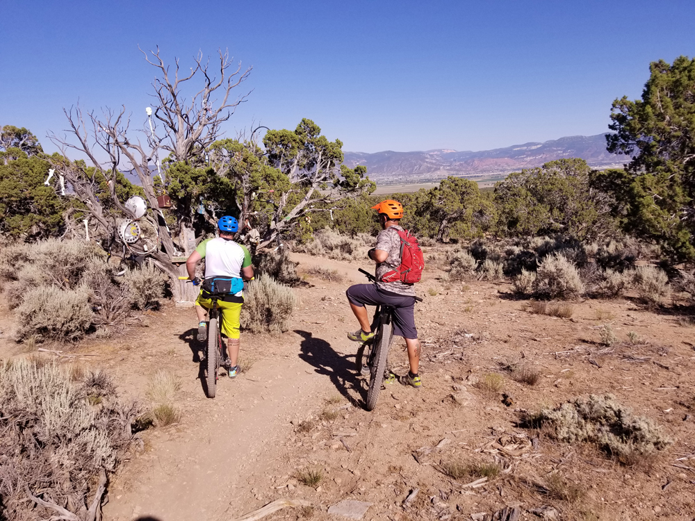
The Three Peaks Recreational Area boasts about 15 miles of singletrack. The trail network is built in a way that shorter sections of trail link together allowing for small, short rides, or longer, more difficult ones. It’s kind of a pick your own adventure type of a place. Speaking of adventure, one of its unique characteristics are added features. The Voodoo Tree is a rather regular looking Juniper that has been decorated with old things that were discarded around the area. You’ll find a bunch of bones, a hub cap and other assorted randomness. There’s also a spot with a grill and a giant pile of bones off to the one side. The additions will give you a chuckle or make you LOL like the kids say these days..
And there are bridges…
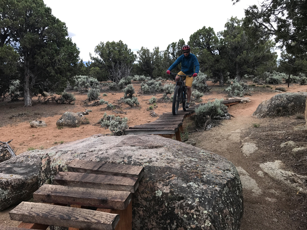
Actually, I’m told for legal reasons they are platforms not bridges, but the idea is the same. You have what is essentially a ladder bridge that gaps over washes, sandy areas and some that even link together rock features. All the bridges have ride arounds if being off the ground isn’t your thing. They are also signed so they won’t catch you off guard. The sign tells you how wide and how high of the ground they are letting you decide what your comfort level is as you work up to some of the higher ones.
All the trails within the network are rated as beginner or intermediate. These trails are a great place to cut your teeth, or spin those legs out as fast as you can. The trails flow well, the climbs aren’t steep and the downhills are a hoot. Take your chances on the bridges, we fell in love with them once we got over our fear of heights.
The key to mastering the bridges is to commit. None of them are narrow enough to require any serious balancing skills. However, once on them stopping to put your foot down can be a bit of an issue. Doing so has been known to result in a tumble back down to the ground. I’ve also found that putting the bike in a slightly harder gear than you would normally pedal helps. It allows you to keep consistent pressure on the pedals. Riding your brakes a little produces the same results. Keeping the pressure on the pedals helps you feel more in control of the bike and will add some confidence as you learn the way of the bridges, er, I mean platforms.
The most popular trail for the network on MTB Project is Lost World. The trail takes advantage of the rock features in the area. You can access Lost World by heading up the Race Course to Big Hole Loop hanging a right and then another right will put you on Lost World for a fun ripping descent.
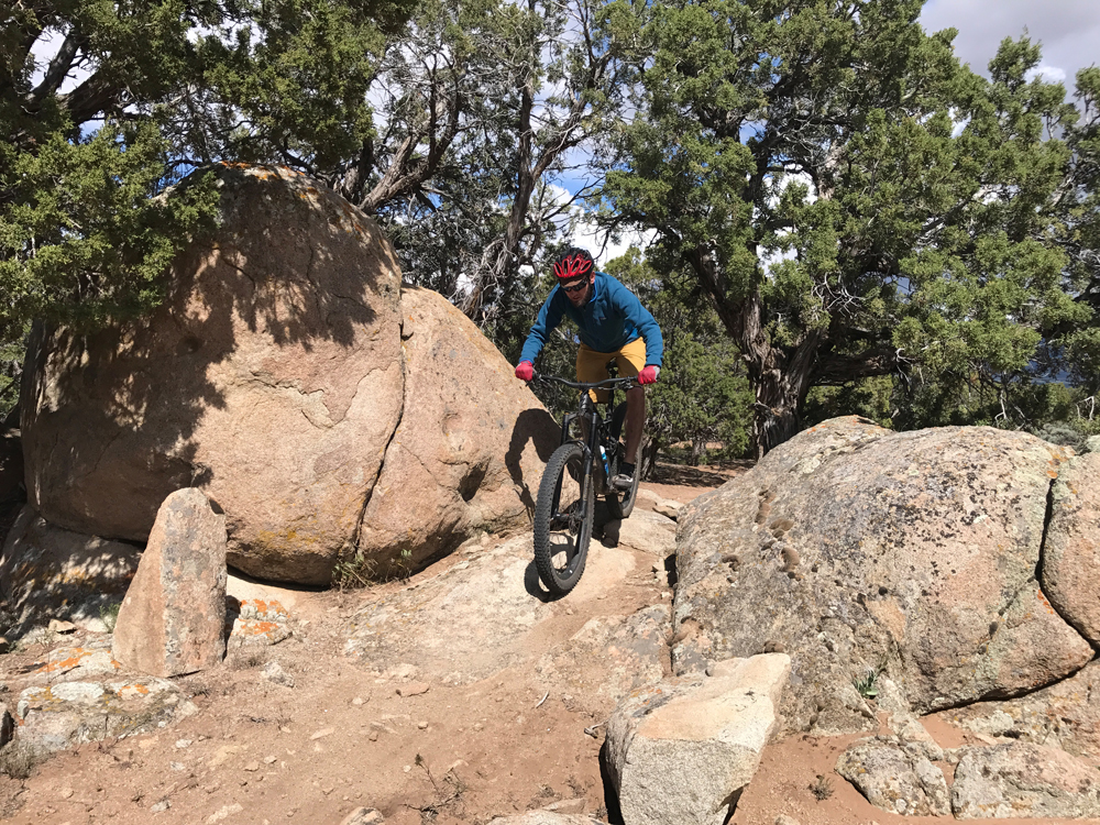
As I mentioned, there are tons of options and variations on how to ride this area. Unfortunately, trying to detail the bigger rides is akin to listening to a Californian give directions. Somehow they always end up on Mulholland Drive. If you can find a local to show you around, it’s the easiest way to learn the system. Otherwise, we recommend checking out the Practice Loop first to warm up your legs. Then hit the Race Course Loop for some classic Three Peaks and then move on to all the other trails until your legs give out or the sun goes down.
The area is well signed. Last time I was out there a couple of weeks ago, all junctions were marked with carsonite signs listing the name of the trail. There is a full network sign at the trailhead. If you are heading out alone, take a picture or list out the trails you want to hit. Once you are out pedaling, there isn’t much to tell you how to get where you want to go. The Practice Loop even has some interpretive signs to help newbies learn the ropes of riding the area.
The Recreation Area has a bunch of other amenities in addition to the trails. There is designated camping, frisbee golf, a shooting range, RC car course and ATV trails. Plenty of things to have your significant other do if they aren’t of the pedaling persuasion or if you want to make a weekend out of it.
Mitch’s wheel takes me right up on the bridge leaving me with one option, pedal it out. We rip over the bridge and back into the Junies. I let out a “Woot!” and all I can think is I love riding in Cedar City.
Getting There
From the South:
- Head North on I-15.
- Take exit 59 for UT-56 toward Cedar City
- Turn right onto UT-56 W/W 200 N
- Turn right onto N 3100 W
- Turn left onto W 4800 N/W Midvalley Rd
- Continue till you see the trailhead
From the North:
- Head south on I-15
- Take exit 62 for UT-130 toward Cedar City/Enoch
- Turn right onto UT-130 N
- Turn left onto E 4800 N/E Midvalley Rd
- Continue till you see the trailhead
Lukas Brinkerhoff blogs about mountain biking and life at mooseknuckleralliance.org.

